You are using an out of date browser. It may not display this or other websites correctly.
You should upgrade or use an alternative browser.
You should upgrade or use an alternative browser.
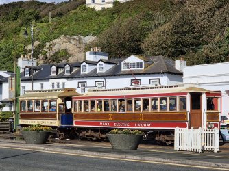
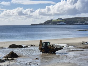
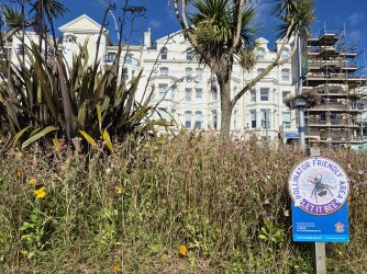
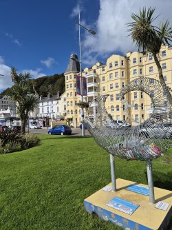
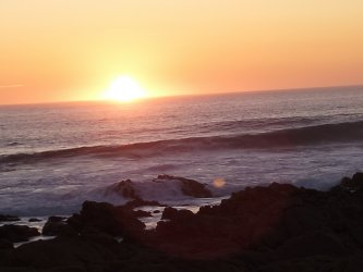
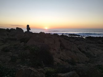
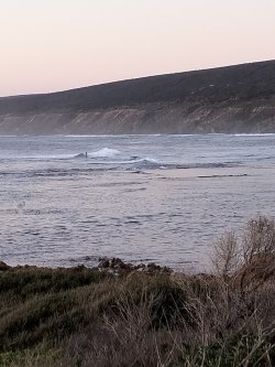
The view or two from my "office"
- Thread starter JessicaTam
- Start date
- Featured
Read our AFF credit card guides and start earning more points now.
AFF Supporters can remove this and all advertisements
RooFlyer
Veteran Member
- Joined
- Nov 12, 2012
- Posts
- 31,207
- Qantas
- Platinum
- Virgin
- Platinum
- Star Alliance
- Gold
A lot in northern Spain earlier this year as well.
The Spanish lot I'd call 'Broome' rather than gorse? But NZ def gorse, just like all over Tas.
@RooFlyer what are those rocks - they look spectacular
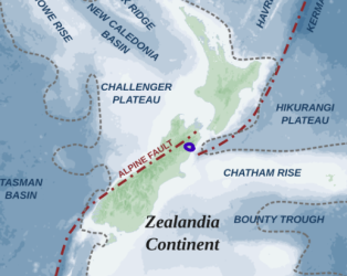
Phwoar! Geological cough. Simply, I'd say highly folded and cleaved (squeezed) sedimentary rocks. Kaikoura is sandwiched between the strands of the Alpine fault so pretty well torn and munched up.
prozac
Senior Member
- Joined
- Jan 7, 2010
- Posts
- 6,144
MrProzac has domestic deafness when I see something unusual and start discussing in my limited geological knowledge.The Spanish lot I'd call 'Broome' rather than gorse? But NZ def gorse, just like all over Tas.
Phwoar! Geological cough. Simply, I'd say highly folded and cleaved (squeezed) sedimentary rocks. Kaikoura is sandwiched between the strands of the Alpine fault so pretty well torn and munched up.
View attachment 407411
When I was young our playground was the local quarry. It had things in it like volcanic dikes. Sadly these iconic structures are now covered as they half filled in the quarry and turned it into a sanitised Bicentennial Park. Nothing to learn there now.
RooFlyer
Veteran Member
- Joined
- Nov 12, 2012
- Posts
- 31,207
- Qantas
- Platinum
- Virgin
- Platinum
- Star Alliance
- Gold
MrProzac has domestic deafness when I see something unusual and start discussing in my limited geological knowledge.
When I was young our playground was the local quarry. It had things in it like volcanic dikes. Sadly these iconic structures are now covered as they half filled in the quarry and turned it into a sanitised Bicentennial Park. Nothing to learn there now.
Well, to get some undivided attention, you should give the whole spiel:
The Kaikoura 1:250 000 geological map covers 18 100 km2 of Westland, Nelson, Marlborough and northern Canterbury in the South Island of New Zealand, and straddles the boundary between the Pacific and Australian tectonic plates. The map area is cut by the Alpine, Awatere, Clarence, Hope and other major strike-slip faults, and includes a wide range of Paleozoic to Mesozoic rocks which form parts of eight tectonostratigraphic terranes. The early Paleozoic Buller and Takaka terranes, comprising sedimentary and volcano-sedimentary rocks respectively, are intruded by mid-Paleozoic granitic rocks of the Karamea Batholith and form the Western Province. This province is separated from the Eastern Province by Mesozoic plutonic rocks of the Median Batholith. North of the Alpine Fault, the Eastern Province comprises the Permian-Jurassic, predominantly volcano-sedimentary Brook Street, Murihiku, Dun Mountain-Maitai and Caples terranes. South of the Alpine Fault the Eastern Province comprises the Triassic-Early Cretaceous sedimentary Rakaia and Pahau terranes, collectively termed the Torlesse composite terrane. The Eastern Province and Western Province were juxtaposed in Late Jurassic to Early Cretaceous time, and subsequently formed a comparatively stable basement to younger Cretaceous and Cenozoic sedimentation. Localised fault activity and clastic sedimentary basin development in the late Early to Late Cretaceous, and again in Late Cenozoic time, contrast with the deposition of widespread, passive margin limestone and mudstone in the Paleocene, Eocene and Oligocene. Late Cenozoic clastic sedimentation reflects development of the present oblique- compressional plate boundary and uplift of the Southern Alps and other ranges. Quaternary glaciation deposited tills and glacial outwash gravels. During warmer interglacial periods, high sea levels cut flights of marine terraces that have been subsequently uplifted. Mined mineral resources within the map area include alluvial gold, salt, coal, limestone, and rock aggregate. Recorded seeps and shows of oil and gas are sparse in the area; there has been no commercial hydrocarbon extraction, and the only petroleum exploration wells have been in the Murchison basin. The Kaikoura map area is subject to severe natural hazards, including a high level of seismic activity from the Alpine, Awatere, Clarence, Hope and other active faults. These have potential for earthquake shaking, landsliding, liquefaction and ground rupture. Several large earthquakes with epicentres within or immediately adjacent to the map area have occurred within the last 160 years. Tsunami hazard may be from remote or local earthquakes or from submarine slumping, particularly within the Kaikoura Canyon immediately offshore. Storm-induced landsliding, rockfall and flooding are ongoing hazards.
VPS
Enthusiast
- Joined
- Apr 2, 2011
- Posts
- 10,496
- Qantas
- LT Gold
- Virgin
- Gold
Well I'm glad they are special because they look amazingThe Spanish lot I'd call 'Broome' rather than gorse? But NZ def gorse, just like all over Tas.
Phwoar! Geological cough. Simply, I'd say highly folded and cleaved (squeezed) sedimentary rocks. Kaikoura is sandwiched between the strands of the Alpine fault so pretty well torn and munched up.
View attachment 407411
- Joined
- Jun 1, 2014
- Posts
- 5,354
If you’re still there and have time, I’d recommend the Oahu Waterfall track.
It’s about 20mins drive north.
Seal pups make their way up stream to play in the pool at the base of the waterfall.
A pretty waterfall and the seals make it a very unusual but enjoyable stop.
IIRC the walk is less than 10min for the car park.
- Joined
- Jan 9, 2016
- Posts
- 2,244
- Qantas
- Platinum
The Spanish lot I'd call 'Broome' rather than gorse? But NZ def gorse, just like all over Tas.
Broom and gorse are two distinctly different plants. Gorse is a darker yellow flower and a prickly, scrubby bush. Broom has clear yellow flowers along long stems.
Cossie
Established Member
- Joined
- Aug 24, 2006
- Posts
- 2,387
If you’re still there and have time, I’d recommend the Oahu Waterfall track.
It’s about 20mins drive north.
Seal pups make their way up stream to play in the pool at the base of the waterfall.
A pretty waterfall and the seals make it a very unusual but enjoyable stop.
IIRC the walk is less than 10min for the car park.
Closed due the earthquake.
RooFlyer
Veteran Member
- Joined
- Nov 12, 2012
- Posts
- 31,207
- Qantas
- Platinum
- Virgin
- Platinum
- Star Alliance
- Gold
Broom and gorse are two distinctly different plants. Gorse is a darker yellow flower and a prickly, scrubby bush. Broom has clear yellow flowers along long stems.
Yes - so would you agree that these plants are Broom?
Muppet501st
Established Member
- Joined
- Aug 22, 2015
- Posts
- 1,159
- Qantas
- Gold
- Virgin
- Platinum
Flyfrequently
Established Member
- Joined
- Jun 20, 2022
- Posts
- 3,394
- Qantas
- Gold
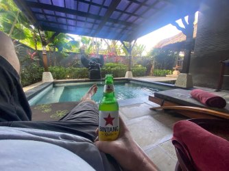
Good to see that you are taking one for the Team @Muppet501stBogan breakfast Bintang beers BaliView attachment 407473
Cossie
Established Member
- Joined
- Aug 24, 2006
- Posts
- 2,387
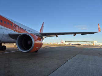
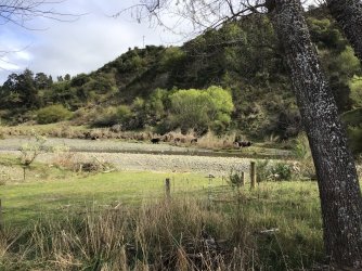
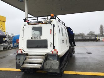
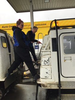
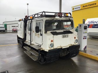
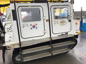
Drive back to CC via the Inland Rd. Rodin cars have their own testing ground here, not sure if they are built there as well, then some quintessential NZ views. Then at the airport, not something you see everyday getting fuel!
The second shot, the white dots are sheep.

 www.rodin-cars.com
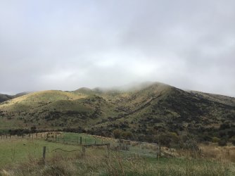
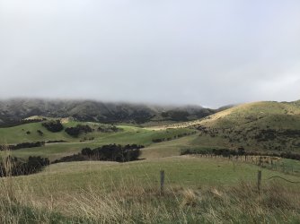
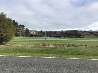
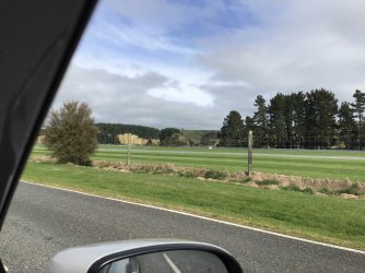
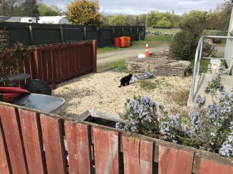
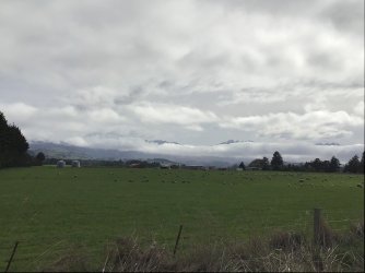
The second shot, the white dots are sheep.
Rodin Cars | FZED | FZERO | Official Website
Rodin Cars is a car manufacturer known for its FZED and FZERO race cars. We have a global presence with locations in New Zealand and the United Kingdom.


Last edited:
- Joined
- Jan 29, 2012
- Posts
- 16,006
- Qantas
- LT Gold
- Virgin
- Red
- Oneworld
- Emerald
Looks like a Hagglund. There used to be one in Falls Creek, for off piste rescues. Fun machines and virtually unstoppable. The rear tracks are also powered.Drive back to CC via the Inland Rd. Rodin cars have their own testing ground here, not sure if they are built there as well, then some quintessential NZ views. Then at the airport, not something you see everyday getting fuel!
The second shot, the white dots are sheep.

Rodin Cars | FZED | FZERO | Official Website
Rodin Cars is a car manufacturer known for its FZED and FZERO race cars. We have a global presence with locations in New Zealand and the United Kingdom.www.rodin-cars.com
View attachment 407494View attachment 407495View attachment 407496View attachment 407497
Hagglunds USA - Selling Tracked Vehicles here in the United States
Hagglunds USA - Selling Tracked Vehicles here in the United States
www.hagglundsusa.com
Become an AFF member!
Join Australian Frequent Flyer (AFF) for free and unlock insider tips, exclusive deals, and global meetups with 65,000+ frequent flyers.AFF members can also access our Frequent Flyer Training courses, and upgrade to Fast-track your way to expert traveller status and unlock even more exclusive discounts!

AFF forum abbreviations
Wondering about Y, J or any of the other abbreviations used on our forum?Check out our guide to common AFF acronyms & abbreviations.
Currently Active Users
- Durian
- paddywide
- FlyingFiona
- Quickstatus
- DasColonel
- wenglock.mok
- Beer_budget
- ms1
- odysseus
- coyote25
- ronone69
- VPS
- grilled_cheeze
- Zero
- miles_collector
- Fridge
- Solid
- vhojm
- sihyonkim
- jkbaus
- azizikhan
- accompanimince
- Z3r0
- drron
- Timratoo
- flyingfan
- JB001
- dajop
- Berlin
- Vekor
- agrias
- Hors Ey
- Elliottt
- Cms99
- wentworthmeister
- JohnM
- DejaBrew
- Rugby
- blackcat20
- tigertraveller
- I love to travel
- cqtiger
- SomeRando
- Jthommo
- r21111
- Dmac59
- jbda2017
- *A Flyer
- OZDUCK
- Kangol
Total: 942 (members: 75, guests: 867)


