You are using an out of date browser. It may not display this or other websites correctly.
You should upgrade or use an alternative browser.
You should upgrade or use an alternative browser.
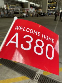
A380 Hudson Fysh comes home to SYD Tuesday 9th November
- Thread starter Princess Fiona
- Start date
- Status
- Not open for further replies.
- Joined
- Jan 24, 2018
- Posts
- 9,703
- Qantas
- Gold
- Virgin
- Platinum
I’d actually be interested in seeing that flight plan decipheredThe plan shows waypoints of the flight's route, each one has unique alpha codes.. that's why it probably does not make a lot of sense, but av geeks would know. eg: MOLLY is located in the Philippines. while TARAAL is at Greenwich Park, on the North Shore of Sydney.
There's other data such as planned flight levels and so on, but hopefully that explains it in very much layman's terms (stop laughing, jb!)
Franky
Established Member
- Joined
- Apr 25, 2015
- Posts
- 2,012
- Qantas
- Bronze
- Virgin
- Red
- Oneworld
- Emerald
Thanks, I get your drift…The plan shows waypoints of the flight's route, each one has unique alpha codes.. that's why it probably does not make a lot of sense, but av geeks would know. eg: MOLLY is located in the Philippines. while TARAAL is at Greenwich Park, on the North Shore of Sydney.
There's other data such as planned flight levels and so on, but hopefully that explains it in very much layman's terms (stop laughing, jb!)
I went here;Thanks, I get your drift…
SkyVector: Flight Planning / Aeronautical Charts
Make your Flight Plan at SkyVector.com. SkyVector is a free online flight planner. Flight planning is easy on our large collection of Aeronautical Charts, including Sectional Charts, Approach Plates, IFR Enroute Charts, and Helicopter route charts. Weather data is always current, as are Jet Fuel...
skyvector.com
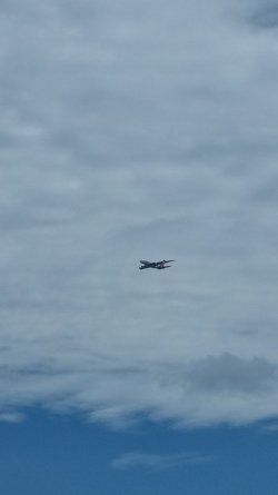
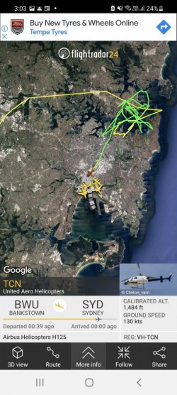
Bugger. I am also on my balcony hoping it was arriving from the north.Damn it! wasn't lucky enough to see it land at Syd.
Looks like it's coming in from the West
It just didn't a West to East fly by..Bugger. I am also on my balcony hoping it was arriving from the north.
Not sure if it will go north or south. Hopefully NORTH.
Maybe it's going to swing around the city.. and the harbour and land from the north
Attachments
Yep I can see him nowIt just didn't a West to East fly by..
Not sure if it will go north or south. Hopefully NORTH.
Maybe it's going to swing around the city.. and the harbour and land from the north
Kendall Roy
Established Member
- Joined
- Jan 16, 2007
- Posts
- 1,088
- Qantas
- LT Gold
- Oneworld
- Sapphire
Welcome home big fella!
Never thought I'd see you again.....
Never thought I'd see you again.....
jb747
Enthusiast
- Joined
- Mar 9, 2010
- Posts
- 13,524
Re the flight plan… DCT means direct, so not on an airway. Basically you go to a waypoint, then track along an airway to another waypoint. So, for example NERIG Y343 ASKOR, means that you joined the Y343 airway at NERIG, and you’ll get off at ASKOR. F330 etc is the planned altitude. The last number 1839 is the planned flight time.
This is only a small part of the complete plan as given to the pilots, and is only related to the route as given to ATC. Manually loading it into an FMC would give you the complete route, but would also include dozens of other waypoints which are on the complete plan. The nav plan also includes fuel burn by leg, safety heights, etc, and then there is a fuel and weight planning section. So, no, you won’t find 250 tonnes in this section, simply because ATC don’t care how many tonnes you have.
This is only a small part of the complete plan as given to the pilots, and is only related to the route as given to ATC. Manually loading it into an FMC would give you the complete route, but would also include dozens of other waypoints which are on the complete plan. The nav plan also includes fuel burn by leg, safety heights, etc, and then there is a fuel and weight planning section. So, no, you won’t find 250 tonnes in this section, simply because ATC don’t care how many tonnes you have.
Franky
Established Member
- Joined
- Apr 25, 2015
- Posts
- 2,012
- Qantas
- Bronze
- Virgin
- Red
- Oneworld
- Emerald
Thanks , appreciate that...Re the flight plan… DCT means direct, so not on an airway. Basically you go to a waypoint, then track along an airway to another waypoint. So, for example NERIG Y343 ASKOR, means that you joined the Y343 airway at NERIG, and you’ll get off at ASKOR. F330 etc is the planned altitude. The last number 1839 is the planned flight time.
This is only a small part of the complete plan as given to the pilots, and is only related to the route as given to ATC. Manually loading it into an FMC would give you the complete route, but would also include dozens of other waypoints which are on the complete plan. The nav plan also includes fuel burn by leg, safety heights, etc, and then there is a fuel and weight planning section. So, no, you won’t find 250 tonnes in this section, simply because ATC don’t care how many tonnes you have.
Read our AFF credit card guides and start earning more points now.
AFF Supporters can remove this and all advertisements
justinbrett
Enthusiast
- Joined
- Mar 6, 2006
- Posts
- 11,769
- Qantas
- Platinum 1
- Oneworld
- Emerald
The plan shows waypoints of the flight's route, each one has unique alpha codes.. that's why it probably does not make a lot of sense, but av geeks would know. eg: MOLLY is located in the Philippines. while TARAL is at Greenwich Park, on the North Shore of Sydney.
There's other data such as planned flight levels and so on, but hopefully that explains it in very much layman's terms (stop laughing, jb!)
Waypoints are actually not unique so there's more than one MOLLY (eg, there's another near El Paso, Texas) and more than one TARAL (another near New Delhi, India). Same deal with the 2/3 letter waypoints which represent a VOR or NDB transmitter, they are also reused - but with huge distances between them so it shouldn't cause a problem.
It's all in context to the air routes you are using, and if you are using points DCT you'll be asked to confirm from a list with the lat/lons specified.
There's actually both a HOOKS and a NOBAR near SYD and also near AKL - theoretically you could have the same waypoint in your flightplan twice referring two two different sets of coordinates.
Last edited:
Rangalad
Active Member
- Joined
- Dec 15, 2012
- Posts
- 581
- Qantas
- Platinum
- Virgin
- Gold
Must...Fly!
Senior Member
- Joined
- Jan 12, 2010
- Posts
- 8,233
- Qantas
- Gold
- Virgin
- Platinum
Happy to see that Fysh came home! And somewhat appropriate the first to come home in the hopefully post health crisis future. For those who know their QF history, he was instrumental in keeping the airline flying through WW2 and remain intact without losing control of all assets to the military effort. Though obviously they did lots for the war effort (and so did their people including those lost).
jb747
Enthusiast
- Joined
- Mar 9, 2010
- Posts
- 13,524
If you type a waypoint in to the FMC, it offers the choices, sorting them by distance. 999 times out of a thousand, the closest is the one you want. There was an accident in the early days of electric jets (a 767 I think), in which they chose the wrong one, and found a large hill in the way.Waypoints are actually not unique so there's more than one MOLLY (eg, there's another near El Paso, Texas) and more than one TARAL (another near New Delhi, India).
For this flight, the navigation flight plan was 9 A4 typed pages, and the NOTAMs and other messages, were 39 pages.
- Status
- Not open for further replies.
Become an AFF member!
Join Australian Frequent Flyer (AFF) for free and unlock insider tips, exclusive deals, and global meetups with 65,000+ frequent flyers.AFF members can also access our Frequent Flyer Training courses, and upgrade to Fast-track your way to expert traveller status and unlock even more exclusive discounts!

AFF forum abbreviations
Wondering about Y, J or any of the other abbreviations used on our forum?Check out our guide to common AFF acronyms & abbreviations.
Currently Active Users
- MELso
- Gudetama
- Daver6
- simmomelb
- ThatMrBlake
- Mattg
- geejay28
- Bolter
- Steady
- Aeryn
- Nate-Dawg
- Jenya
- Thibault
- Kristian
- Happy Dude
- offshore171
- SnowGoose
- RB001
- Falcs
- cgichard
- Mr_Tee
- markis10
- JimmyJ
- mviy
- grilled_cheeze
- MEL_Traveller
- im.daniel
- tassie6
- cheamium
- qq2233
- opusman
- kearvaigskewer
- Brettmcg
- andye
- drcam
- RadioBusinessTraveller
- prelude
- flyingfan
- Beer_budget
- bluecoconut
- kpro
- http_x92
- madrooster
- Austman
- trisreed
- Pete98765432
- Tindersinder
- ols
- yangry
- Warragul
Total: 781 (members: 64, guests: 717)


