Cairns & North-A Road Trip

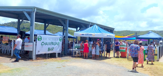
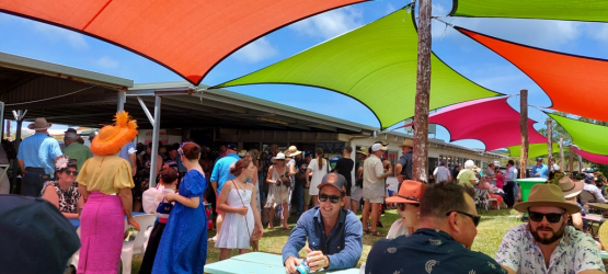
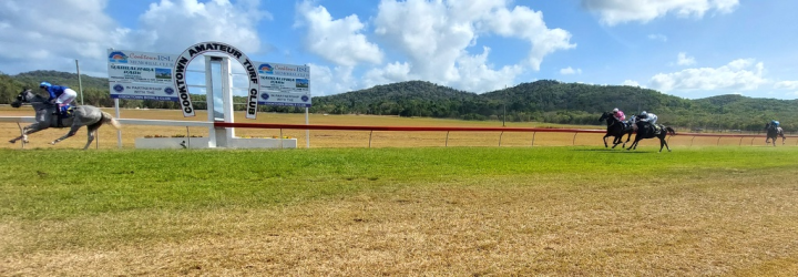
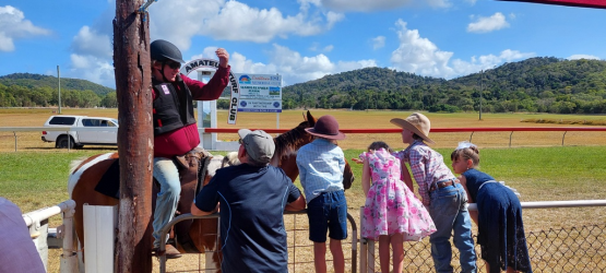
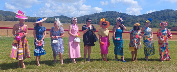
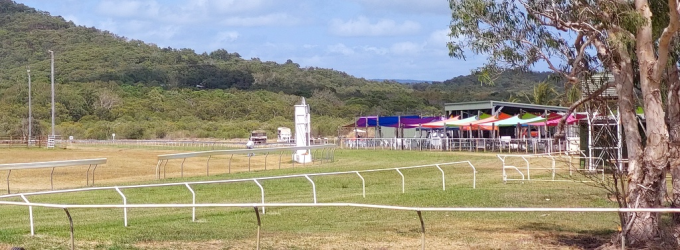
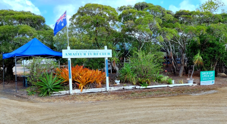
Cooktown Cup 2023- the track is certainly no Randwick or Flemington but hosts a fabulous country horse meeting. Plenty of Fashion on the Field contestants through many classes, competitive racing, 5 bookies on course and great food choices. We didn’t partake in the human foot races and also bailed before the post-race band started.

1701129197284.png

1701129219976.png

1701129306753.png

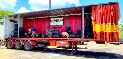
The post race entertainment- Black Image Band (Albums & songs) - Creative Spirits

1701129275011.png

1701129331843.png

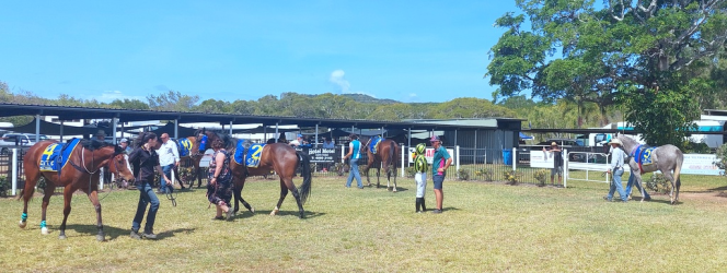
Parade ring
1701129373654.png

1701129399731.png

The Clerk of the Course had a popular mount
1701129451215.png

1701129477080.png

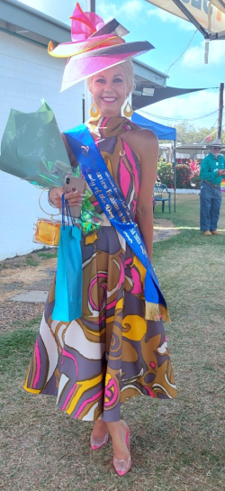
Mrs RB thought the judges got it right
1701129593091.png
 
More of Around Cooktown
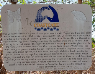
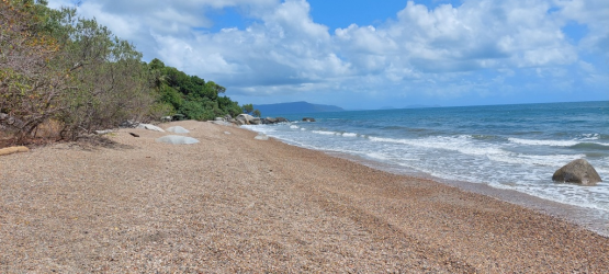
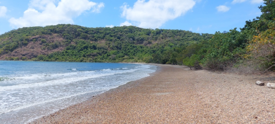
Quarantine Bay- a short drive from town & provided the contrast of a stony beach-another beautiful location
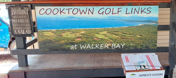
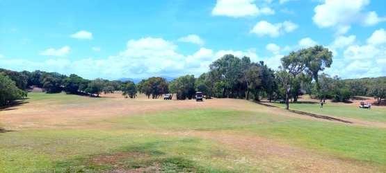
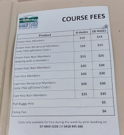
Cooktown Golf Club-9 greens, 18 tees and some challenging undulations & I would suspect pretty windswept a lot of the time. Very casual & some guys were driving their car around the course as all the buggys were already in use.
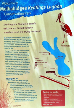
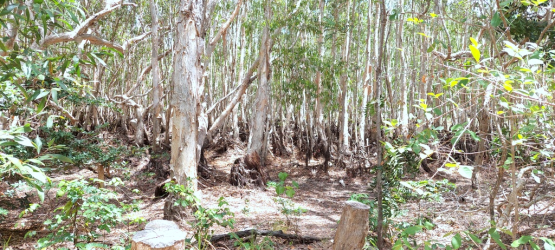
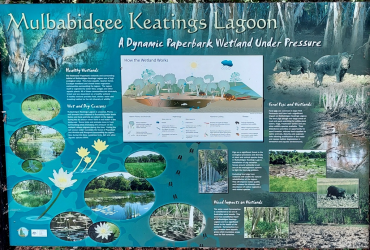
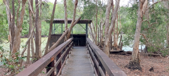
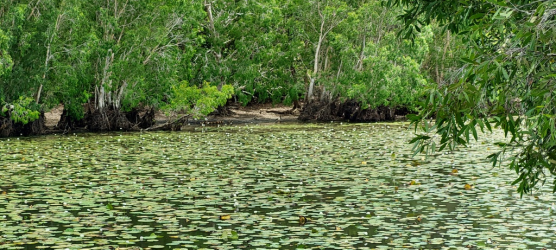
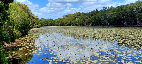
Keatings Lagoon- on the road to Mount Molloy- a well set up bird hide at the end of a well maintained track. Still a reasonable amount of water & a few species of birds enjoying the environment.
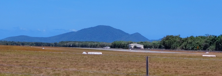
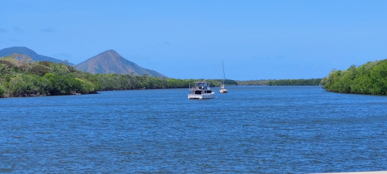
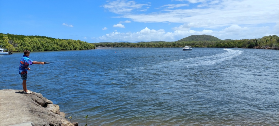
Hope Vale-a bit of a drive with plenty to see on the ways but really nothing to see there-the pool seemed to be the only thing open. I think we should have driven on to see the Coloured Sands. We drove past the airport and checked a couple of boat ramps upstream from Cooktown on the way back.

1701151210117.png

Quarantine Bay much different surface to the other bays we visited
1701151245231.png

1701151267000.png

1701151291540.png

Very few flat lies
1701151418000.png

Cheap golf
1701151446554.png

1701151474745.png

1701151495300.png

1701151513952.png
 
Cooktown to Kuranda

A day that involved the most back tracking-Cooktown to Mt Molloy & then we were in new territory. More easy driving with good road conditions.

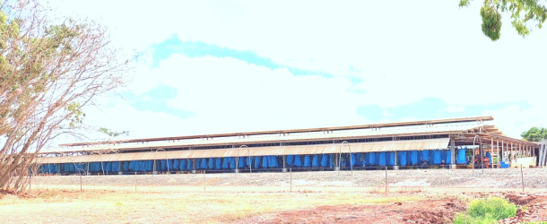
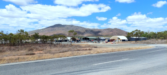
Small part of the packing shed for bananas at Lakeland Red Valley: Processes
1701207908056.png

Back through Mt Carbine
1701208053114.png

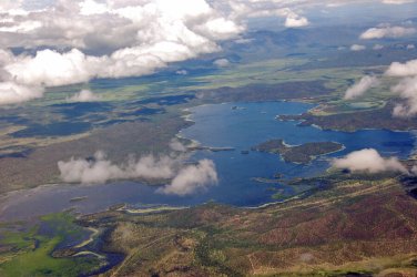
From Mt Molloy to Mareeba there is again a big variety of vegetation & another highlight is Southedge Lake- an aerial shot (not mine) shows it well.
1701207671724.jpeg
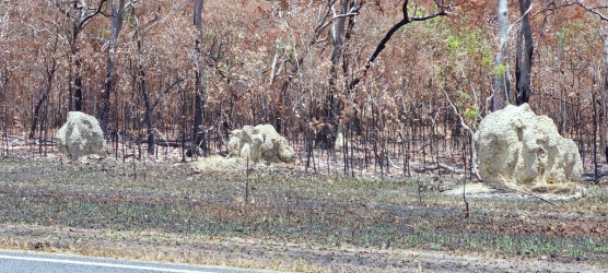
This section of highway boasts some of the largest termite mounds- some look like cattle beasts in the distance. We grabbed a fantastic version of a kebab at Mareeba from Mareeba Kebab & More- excellent fresh ingredients & a great wrap.
Mareeba is a service centre for many farmers & the big wide streets were busy with traffic. Tobacco has now given way to bananas, coffee, avocadoes,lychee,mangoes, pineapples, passionfruit and spuds. The agriculture is supported by irrigation from Lake Tiroo and the Barron River.
We had a drive through Speewah. We had intended staying there but were put off by recent reviews and the way the owners had reacted to the reviewers.
By the time we reached Kuranda the stall holders had called it quits so we visited the IGA & sought out our accommodation.
 
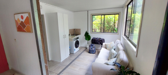
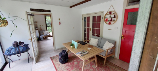
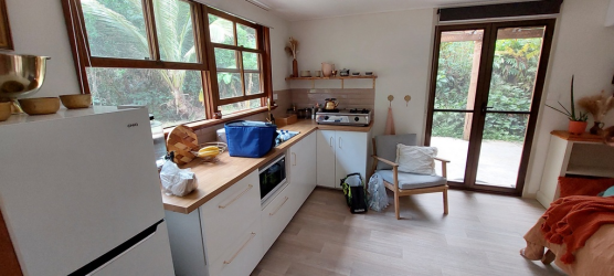
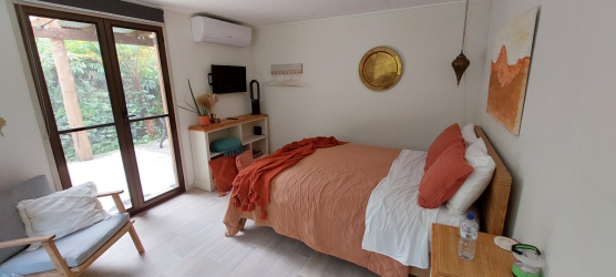
Tranquil Rainforest Studio Kuranda
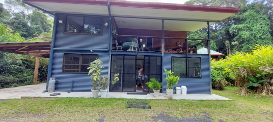
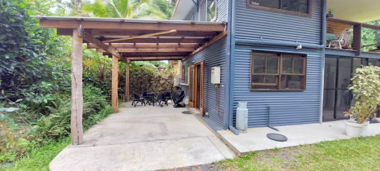
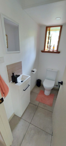
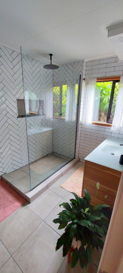
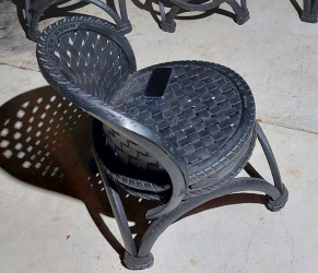
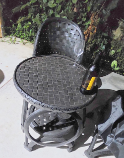
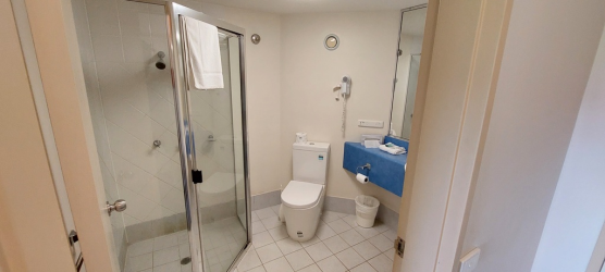
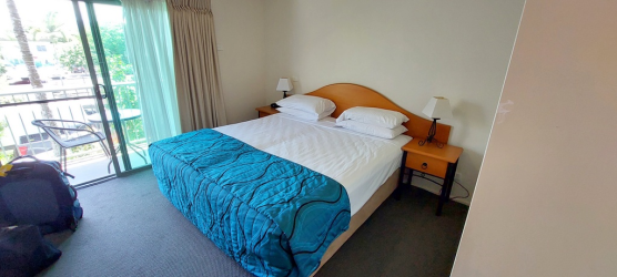
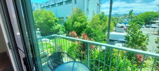
A last minute decision to have a 1 night stay here. Turned out to be an excellent experience. Tucked away from the main road down a shared access road, it is located in the rainforest. The external structure is a bit basic but the fit-out is nice and very comfortable. Very good bathroom facilities, a super comfortable bed and all facilities were newish & worked. We used the supplied weber BBQ & ate in the outdoor facility. The outdoor setting was super comfortable- we hadn’t encountered Retyred furniture before but we were very impressed retyred furniture - Google Search
Studio is lower level
1701237057430.png

1701237080654.png
1701237113183.png
1701237133522.png
1701237151987.png
1701237171852.png
1701237193215.png
1701237215076.png

Probably the most comfortable outdoor seat I have used

1701237300088.png

1701237325239.png
 
Lake TINAROO...yes originally for tobacco, you can still see the irrigation channels beside the roads.
Now it is about the only safe spot to swim in FNQ and will be busy with watersports as it gets hotter. Crops have booms and busts, avocados, lychees, sugar, peanuts...you can grow nearly anything up here but then too many get involved and prices crash.

Southedge Lake was supposed to be similar. The developer was buddies with Sir Joh and the Nationals back in the day and got approval to build it, there is a bitumen road from there to the coast, comes out at Hartleys Creek Crocodile farm, but it was not allowed to proceed after govt changed and greenpower Labour got in. So another half finished stuff up...
The same developer got rich in the first place by bulldozing the Daintree, getting the Bloomfield track through and selling a pipe dream to gullible southerners.

Lakeland was another dream that has boomed and busted a dozen times. But ultimately it is just too far away from markets. The last boom was after Yasi, as they had the only bananas in Qld...remember when they hit $10 a kg?
Sorry, I am going to sack the proof reader.:)

I think agriculture all over suffers from being price takers. Avocado farmers around here are now under pressure- used to get good prices by being in season at a different time but we are now regularly buying at $4 a kilo.
Dreams have been everywhere- I remember a classmate's father used to sell pine tree investments, no pds needed in those days!
 
Kuranda to Cairns
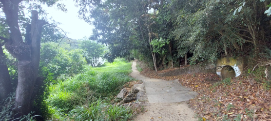
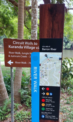
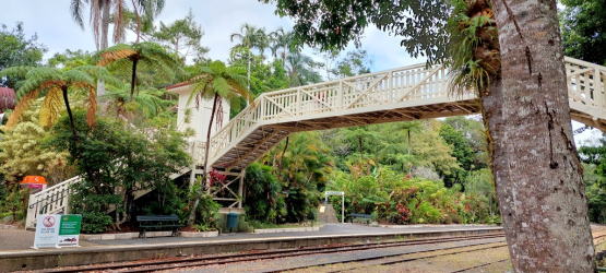
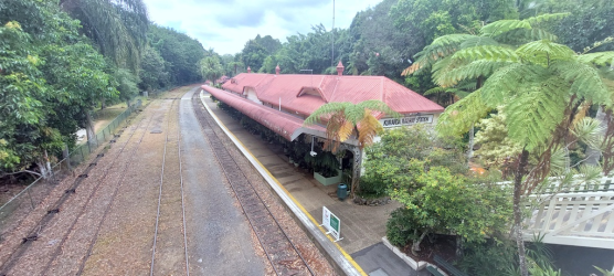
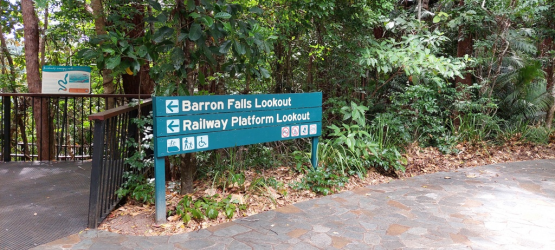
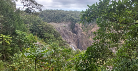
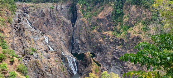
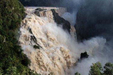
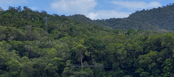
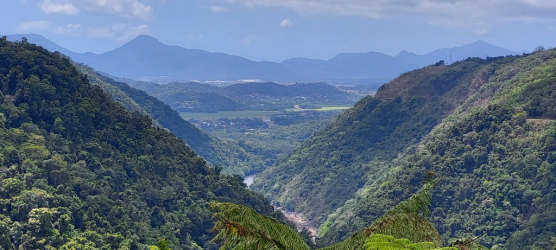
Last day with the car due back mid afternoon. We had visited the markets many years ago so they were not a priority. We did part of the river walk, back up through the train station & then into the car to the Barron Falls Lookout walkway-just saw the roof of the train as we walked & then reached the various lookout spots. Certainly not a huge volume of water compared to some peak season photos I have seen. From there we visited Wrights Lookout & a short part of the track leading off from there.
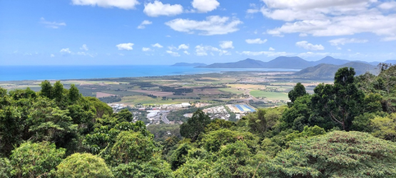
On the drive to Cairns we stopped off for the Henry Ross Lookout.

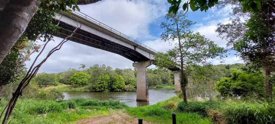
Start of the river walk- current roadworks had the bridge reduced to 1 lane
1701304162692.png

1701304270985.png

1701304292118.png

1701304320478.png

1701304349177.png
 
My father was offered a job in Mareeba, as tobacco growing up there was going to be big. He worked for the Soils dept within CSIRO, can’t remember if it would have been a CSIRO job or not. I do remember mum not being overly interested. :)
Can’t say I’m sorry we didn’t go.
Also, a question for @jastel is it possible to drive from there to Hartley’s through the forest without a 4x4?
Great tr, we have a booking for the Reef House, end of June, and this time I want to get to Cooktown as well, so lots of good info here, thanks.
 
My father was offered a job in Mareeba, as tobacco growing up there was going to be big. He worked for the Soils dept within CSIRO, can’t remember if it would have been a CSIRO job or not. I do remember mum not being overly interested. :)

Quite likely. Strange as it may seem these days, CSIRO had a Tobacco Research Institute at Mareeba. It was part of the Division of Plant Industry, not Division of Soils, but being concerned with agronomic issues affecting production, soils and fertilisers were relevant.

It existed from about the mid-1950s to, IIRC, about the mid 1970s by which time tobacco production, which had also occurred in the King Valley in Victoria and around Manjimup in SW Australia, had died out to be replaced by horticulture and later viticulture.
 
And tobacco was grown around the Sunshine Coast as well. You can still see an Oast house from the Bruce highway on your left travelling south a little before the rest stop south of Caloundra from which you can access the Wild Horse Mountain lookout.
 
The entire Kuranda Range road and Bridge has been a sore point here for a decade or more.
Most locals want a tunnel up there, great environmentally but Qld cant afford anything atm let alone a $2 Billion tunnel, with Anna's Games hoovering all the cash up.
There are one or two alternate proposals for traditional roads but they are not much cheaper and will kill trees so they get no airtime.

A resort was proposed before Covid up that way, DTMR (Qld Transport) said NO the range road is AT CAPACITY, no development allowed.
Prior to the last election the tunnel calls came again, DTMR said NO the road is good for another 30 years??

Just after the election the bridge (in the photo) was restricted to one lane while they investigated major cracking and faults, it is 60 years old, after 12 months of traffic jams and repairs it was opened to 2 lanes again, for about 2 months before being reduced to one lane again...
They spent $500000 on a study asking locals would they like a NEW bridge or repair the old one...any guesses what the answer was?

They decided to spend $40 million and dig 7km of cables to enable changeable traffic speed limit signs and traffic cameras so they can raise (yeah right) and lower the speed limits depending on conditions...with 2 speed cameras attached as well to fund the olympics. This should be active soon. I used to 100kmh in the dry up that hill in my HQ Kingswood back in the day...now its all 60kmh max, with a brief squirt of 70 on the straight to overtake that annoying Southerner in his van...who miraculously speeds up???

All tourists, locals and most freight goes on these roads...freight on the railways up the hill doesnt really happen up here, again Queensland Rail says the tracks are not good enough...so same argument as the road...spend Billions and destroy trees or leave it for the next govt to worry about...they always pick the second one.

The locals are thoroughly sick of the political games with this road, they just want a road that gets them to the tablelands, we have seen the view before, so we can drive over 20kmh unlike the tourists and their caravans poking along and refusing point blank to move over where the road allows in several spots. There is often a mobile speed camera "for safety" in these spots but.
Then every time it rains, and also sometimes when it doesn't, some wombat will go over the edge meaning the road will be shut for 4-6 hours while the crash is cleaned up and invesigated.

RB didnt say how busy it was...but I reckon he could times it by 4 in the peak periods of June/July and see how he likes the drive then.

For those that dont know there are 4 main bitumen roads "up" the hill from the coast around here. Cairns has the Kuranda Range, which we are talking about, one hour North near Mossman is the Rex Range which RB did the other day to Mount Molloy and Cooktown, then 30 minutes South of Cairns at Gordonvale is the Gillies Range, twice as long and twisty as Kuranda but a bit less traffic, Then one hour South at Innisfail is the Palmerston range. So if your preferred road is closed due to accident/flood/roadworks etc it will be 2 hour detour. All suffer from the same problems of regular closures. They are mostly one lane each way and limited overtaking. Though not a road "up" the scenic Cook Highway from Cairns to Port Douglas should be on this list too as it has exactly the same problems.

Cossie these are the only legal roads from tablelands to the coast, 4x4 or not. The Quaid Road from Southedge Lake to Hartleys Creek is gated and has boulders etc blocking it but often the lock is smashed by 4x4 ers and trail bikers, so you may get on it but when you get to the other end it is blocked there or somewhere in the middle. The road was bitumen but never maintained (or built to a good enough standard in the first place according to govco ) and many years of floods and erosion have taken their toll. I am not sure of the current conditions but it is closed and illegal but adventurous people still go on it at their own risk.

There are 4x4 tracks through the forest in various points all over the tablelands but most are circular or to waterfalls/views etc and there are no publicly accessible tracks to the coast...one 4x4 track comes down to Lake Morris Dam and goes across the gated spillway but you need keys from the Water Dept or National Parks. There used to be a tour company with permission for this track but not sure if it still goes. Mountain Bikers and hikers can get away with just jumping the gates but. Then you have the problem of getting back to the top where you left your car...
 
Thanks, we have driven all three roads that you mentioned, I really liked the Palmerston road, going down hill, there wasn’t much traffic that made it good. Also the road from Gordonvale was fun as well. Think we will just go up the main road to Cooktown. Thanks again both of you for advise.
 
They can all be good roads in the right conditions...no traffic, trucks or caravans, no closures, no speed cameras etc...I have had good runs and bad ones as well. Many people live up there and drive up and down these roads every day. On a nice weekend all the classic car guys and motorbikers go for a drive.
 
The entire Kuranda Range road and Bridge has been a sore point here for a decade or more.
Most locals want a tunnel up there, great environmentally but Qld cant afford anything atm let alone a $2 Billion tunnel, with Anna's Games hoovering all the cash up.
There are one or two alternate proposals for traditional roads but they are not much cheaper and will kill trees so they get no airtime.

A resort was proposed before Covid up that way, DTMR (Qld Transport) said NO the range road is AT CAPACITY, no development allowed.
Prior to the last election the tunnel calls came again, DTMR said NO the road is good for another 30 years??

Just after the election the bridge (in the photo) was restricted to one lane while they investigated major cracking and faults, it is 60 years old, after 12 months of traffic jams and repairs it was opened to 2 lanes again, for about 2 months before being reduced to one lane again...
They spent $500000 on a study asking locals would they like a NEW bridge or repair the old one...any guesses what the answer was?

They decided to spend $40 million and dig 7km of cables to enable changeable traffic speed limit signs and traffic cameras so they can raise (yeah right) and lower the speed limits depending on conditions...with 2 speed cameras attached as well to fund the olympics. This should be active soon. I used to 100kmh in the dry up that hill in my HQ Kingswood back in the day...now its all 60kmh max, with a brief squirt of 70 on the straight to overtake that annoying Southerner in his van...who miraculously speeds up???

All tourists, locals and most freight goes on these roads...freight on the railways up the hill doesnt really happen up here, again Queensland Rail says the tracks are not good enough...so same argument as the road...spend Billions and destroy trees or leave it for the next govt to worry about...they always pick the second one.

The locals are thoroughly sick of the political games with this road, they just want a road that gets them to the tablelands, we have seen the view before, so we can drive over 20kmh unlike the tourists and their caravans poking along and refusing point blank to move over where the road allows in several spots. There is often a mobile speed camera "for safety" in these spots but.
Then every time it rains, and also sometimes when it doesn't, some wombat will go over the edge meaning the road will be shut for 4-6 hours while the crash is cleaned up and invesigated.

RB didnt say how busy it was...but I reckon he could times it by 4 in the peak periods of June/July and see how he likes the drive then.

For those that dont know there are 4 main bitumen roads "up" the hill from the coast around here. Cairns has the Kuranda Range, which we are talking about, one hour North near Mossman is the Rex Range which RB did the other day to Mount Molloy and Cooktown, then 30 minutes South of Cairns at Gordonvale is the Gillies Range, twice as long and twisty as Kuranda but a bit less traffic, Then one hour South at Innisfail is the Palmerston range. So if your preferred road is closed due to accident/flood/roadworks etc it will be 2 hour detour. All suffer from the same problems of regular closures. They are mostly one lane each way and limited overtaking. Though not a road "up" the scenic Cook Highway from Cairns to Port Douglas should be on this list too as it has exactly the same problems.

Cossie these are the only legal roads from tablelands to the coast, 4x4 or not. The Quaid Road from Southedge Lake to Hartleys Creek is gated and has boulders etc blocking it but often the lock is smashed by 4x4 ers and trail bikers, so you may get on it but when you get to the other end it is blocked there or somewhere in the middle. The road was bitumen but never maintained (or built to a good enough standard in the first place according to govco ) and many years of floods and erosion have taken their toll. I am not sure of the current conditions but it is closed and illegal but adventurous people still go on it at their own risk.

There are 4x4 tracks through the forest in various points all over the tablelands but most are circular or to waterfalls/views etc and there are no publicly accessible tracks to the coast...one 4x4 track comes down to Lake Morris Dam and goes across the gated spillway but you need keys from the Water Dept or National Parks. There used to be a tour company with permission for this track but not sure if it still goes. Mountain Bikers and hikers can get away with just jumping the gates but. Then you have the problem of getting back to the top where you left your car...
At home, our way over the range is Port Macquarie/Walcha/Tamworth. We had a spot controlled by a traffic light for 10 yrs. Then we had fires in 2019 where it was completely closed for a period & then controlled flow. In March 2021 we had floods & the highway still closes completely at times. This is predicted to last until some time in 2024. Oxley Highway Flood Recovery notification April 2022 - oxley-highway-flood-recovery-notification-04-2022.pdf. and Oxley Highway Disaster Recovery - Fact sheet November 2022 - oxley-highway-flood-recovery-fact-sheet-2022-11.pdf
So at least 5 yrs where some country towns are struggling to have regular access to land transport
 
Turn business expenses into Business Class! Process $10,000 through pay.com.au to score 20,000 bonus PayRewards Points and join 30k+ savvy business owners enjoying these benefits:

- Pay suppliers who don’t take Amex
- Max out credit card rewards—even on government payments
- Earn & Transfer PayRewards Points to 8+ top airline & hotel partners

AFF Supporters can remove this and all advertisements

1300 Meteor Car Rental

Another fine experience with the drop-off. We were greeted warmly, questioned if there were any car concerns and then a cursory check of the car. We had added around 1,300km on to the car. A very friendly chat & then we were soon in an uber to our hotel.

Around Cairns
Incredible changes since our last visit and I find it difficult to recall any locations & buildings from the previous time.
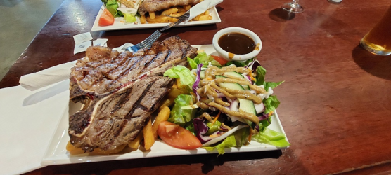
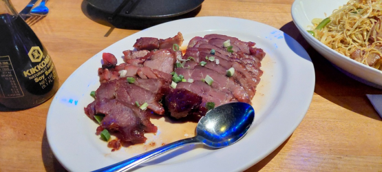
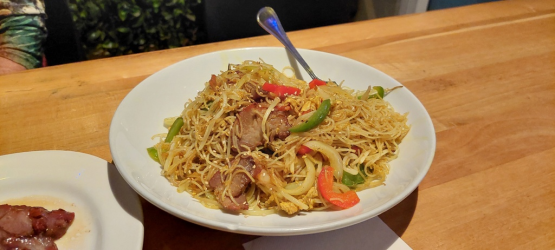
We walked from the northside along the esplanade and settled on a Jacks Hotel lunch- a well cooked t bone with a beaut salad & a cold tap beer. Mrs RB checked the shops while I wandered back to the hotel for a quiet afternoon. A couple of drinks at the very busy cough & Bull hotel and then dinner at the Yum Sing Chinese- nice enough food but nothing outstanding. Back to the hotel for an early night.

1701386118054.png

1701386140951.png

1701386172559.png

Jacks Hotel excellent counter lunch
1701386198608.png

Great display at cough & Bull Hotel
1701386218684.png

1701386302512.png

Yum Sing pork dish
1701386324131.png

Singapore noodles
1701386347077.png
 
Heritage Hotel Cairns-Minnie St
A 1 night stay with no real requirements other than a comfortable bed & good air conditioning. Most requirements met and generally a neat and tidy older hotel. This is a very quiet location but the lack of maintenance on the air conditioner with filthy filters meant the system struggled badly. I got to use a booking.com wallet credit so a very cheap stay-Cairns hotels seemed expensive for what they offered.


1701386635772.png

1701386658929.png

1701386683308.png
 
VA 780-CNS-BNE
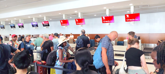
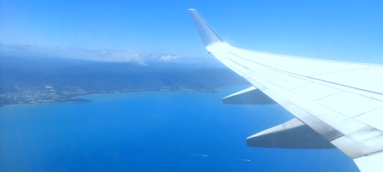
An easy Uber transfer to the airport & 15 minutes saw us through all formalities (belts off, laptop out). We found Cairns to be a comfortable experience with plenty of seating choice. The food prices seemed to be typical airport expensive although there were quite a few alternative outlets. This flight has an average delay of 20 minutes & ours was not going to be any different-late inbound, a tight turn around, front & back door used for loading but people managing to mess it up, bags still being loaded after departure time, slow paperwork etc. The plane was full (only noticed 1 spare seat in back row) but the baggage was fairly prompt in delivery. The public pick-up point was very orderly.
1701485530784.png

1701485578610.png

We had a night in Brisbane- hotter & more humid than what we had been experiencing and then it was a drive home to Port Macquarie. Only 16 days from leaving home until our return but the landscape had been transformed in that time.-rain had made a massive change everywhere and people were no longer having to wait multiple weeks to buy water!

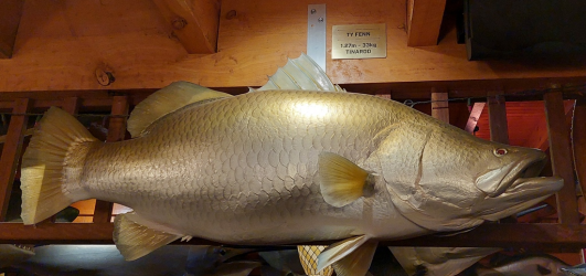
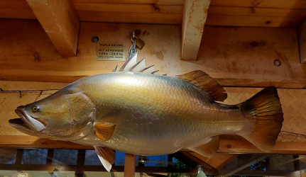
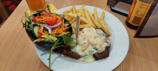
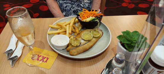
Back to Geebung RSL.-Reef & Beef & Grilled Barra this time around

1701485718459.png

1701485746535.png

So that winds up another Nth Qld road trip. I have written up the other 2 on here also. We thoroughly enjoyed these visits and certainly found plenty to look at and the locals have always treated us well
No Cassowary Sightings for Us | Australian Frequent Flyer
Platypus, Beaches and Pies on the Whitsunday Coast | Australian Frequent Flyer
 
VA 780-CNS-BNE
An easy Uber transfer to the airport & 15 minutes saw us through all formalities (belts off, laptop out). We found Cairns to be a comfortable experience with plenty of seating choice. The food prices seemed to be typical airport expensive although there were quite a few alternative outlets. This flight has an average delay of 20 minutes & ours was not going to be any different-late inbound, a tight turn around, front & back door used for loading but people managing to mess it up, bags still being loaded after departure time, slow paperwork etc. The plane was full (only noticed 1 spare seat in back row) but the baggage was fairly prompt in delivery. The public pick-up point was very orderly.
View attachment 355696

View attachment 355697

We had a night in Brisbane- hotter & more humid than what we had been experiencing and then it was a drive home to Port Macquarie. Only 16 days from leaving home until our return but the landscape had been transformed in that time.-rain had made a massive change everywhere and people were no longer having to wait multiple weeks to buy water!

Back to Geebung RSL.-Reef & Beef & Grilled Barra this time around

View attachment 355698

View attachment 355699

So that winds up another Nth Qld road trip. I have written up the other 2 on here also. We thoroughly enjoyed these visits and certainly found plenty to look at and the locals have always treated us well
No Cassowary Sightings for Us | Australian Frequent Flyer
Platypus, Beaches and Pies on the Whitsunday Coast | Australian Frequent Flyer
Thanks for taking us on the road @RB , great report 🇦🇺
 

Become an AFF member!

Join Australian Frequent Flyer (AFF) for free and unlock insider tips, exclusive deals, and global meetups with 65,000+ frequent flyers.

AFF members can also access our Frequent Flyer Training courses, and upgrade to Fast-track your way to expert traveller status and unlock even more exclusive discounts!

AFF forum abbreviations

Wondering about Y, J or any of the other abbreviations used on our forum?

Check out our guide to common AFF acronyms & abbreviations.
Back
Top