Covid Revised: Roaming near Rudall River/Karlamilyi National Park

You blokes should have gone looking before spending the day in the Mt Magnet pub... 😜
Ooooh! So very unkind! I'll have you know we did our imbibing of fine wines at various carefully curated alfresco locations in the Murchison.

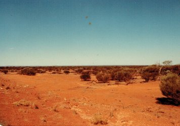
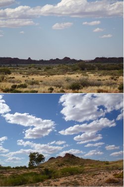
But first of all, people should know that the place is blessedly free of roadside weeds for most of the time:

MM1.jpg

Anyone see a crater?

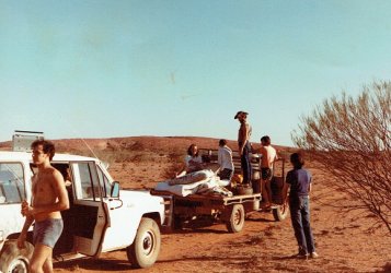
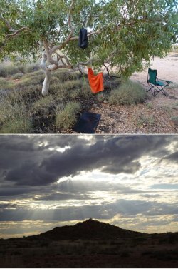
MM2.jpg

An example of one of our carefully curated alfresco locations - and a distinct shortage of yer fancy pants, air con, dial-a-matic, 5WD roller-wannabes, too!!

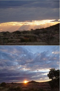
MM3.jpg

MM5.jpg

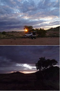
Another fine wine & dine experience:

MM4.jpg

MM6.jpg

Loved the outback. ;) Perhaps I should make the above into a Trip Report :oops:
 
I was going to ask you this directly, but figure it will be useful public info...

If someone in Perth was keen to go see the flowers, would mid September be too late? Also if they were keen to avoid unsealed roads, where would be the better spots to head to? Say over a few days kind of trip.
 
Read our AFF credit card guides and start earning more points now.

AFF Supporters can remove this and all advertisements

Thanks for a lovely report - which does give some food for thoughts along the lines of Daver6.
 
I was going to ask you this directly, but figure it will be useful public info...

If someone in Perth was keen to go see the flowers, would mid September be too late? Also if they were keen to avoid unsealed roads, where would be the better spots to head to? Say over a few days kind of trip.

Given the late rains in the Murchison, mid-September should not be too late. My advice to anyone is try to make the most of this sensational season; they don't come around this good very often.

Scope: Nature's Calendar Wildflowers

I wouldn't be too concerned about taking SWMBO's buzz-box on the dirt in the Murchison. As I noted, many of the roads are solid sandy loam and are smoother than bitumen. There are few minor washouts around, but nothing of any concern to even a small car. In any event, if scoping the wildflowers, you are unlikely to be travelling too fast to miss seeing them.

The unsealed roads will be much, much more benign than the stony stuff in the Gascoyne.

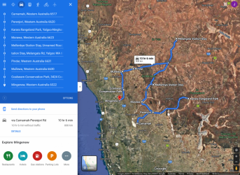
All the roads through Carnamah, Perenjori, Morawa (has a good info centre) to Yalgoo and E to Mt Magnet or W to Mullewa are sealed.

The show is spectacular around Yalgoo - from Mellenbye through Yalgoo to Melangata and out towards Mt Magnet. The dirt road from Yalgoo to Cue via Melangata, Dalgaranga crater and Walga Rock (which you did last year, I think) is all good for a small/2WD car.

I'd recommend trying to get into Melangata or Mellenbye. Might be hard though; it's a wildflower feeding frenzy out there. Jo at Melangata
does the full catered thing in the homestead, but if you want something a bit different, scope whether you could get a room in the shearers' quarters like I did and do your own catering in the camp kitchen. It was a blast. If it's after I get back on 29 August, I can loan you my car fridge and Li battery.

I would tend to stick SW of Melangata; the show gets a patchier further NE, and will be the earliest to fade with warm, dry weather. There is accommodation at the Yalgoo Hotel, but I'd suspect it's basic - although it could surprise on the upside: Yalgoo Hotel-Motel » Shire of Yalgoo. It would certainly be a PERfect location for venturing in several directions for day trips.

I can give you about five spot-on locations for the wreath flowers. There's also one at Pindar, between Yalgoo and Mullewa. Not sure exactly where, but Mullewa information centre or Google will know and it will likely be signposted.

Karara Rangelands should be good: KARARA RANGELAND PARK – VISIT PERENJORI

Coalstream reserve near Mingenew is reputedly a good wildflower spot: Coalseam | Explore Parks WA | Parks and Wildlife Service

1629187185008.png


Digest that, and we can talk tomorrow night.
 
Given the late rains in the Murchison, mid-September should not be too late. My advice to anyone is try to make the most of this sensational season; they don't come around this good very often.

Scope: Nature's Calendar Wildflowers

I wouldn't be too concerned about taking SWMBO's buzz-box on the dirt in the Murchison. As I noted, many of the roads are solid sandy loam and are smoother than bitumen. There are few minor washouts around, but nothing of any concern to even a small car. In any event, if scoping the wildflowers, you are unlikely to be travelling too fast to miss seeing them.

The unsealed roads will be much, much more benign than the stony stuff in the Gascoyne.

All the roads through Carnamah, Perenjori, Morawa (has a good info centre) to Yalgoo and E to Mt Magnet or W to Mullewa are sealed.

The show is spectacular around Yalgoo - from Mellenbye through Yalgoo to Melangata and out towards Mt Magnet. The dirt road from Yalgoo to Cue via Melangata, Dalgaranga crater and Walga Rock (which you did last year, I think) is all good for a small/2WD car.

I'd recommend trying to get into Melangata or Mellenbye. Might be hard though; it's a wildflower feeding frenzy out there. Jo at Melangata
does the full catered thing in the homestead, but if you want something a bit different, scope whether you could get a room in the shearers' quarters like I did and do your own catering in the camp kitchen. It was a blast. If it's after I get back on 29 August, I can loan you my car fridge and Li battery.

I would tend to stick SW of Melangata; the show gets a patchier further NE, and will be the earliest to fade with warm, dry weather. There is accommodation at the Yalgoo Hotel, but I'd suspect it's basic - although it could surprise on the upside: Yalgoo Hotel-Motel » Shire of Yalgoo. It would certainly be a PERfect location for venturing in several directions for day trips.

I can give you about five spot-on locations for the wreath flowers. There's also one at Pindar, between Yalgoo and Mullewa. Not sure exactly where, but Mullewa information centre or Google will know and it will likely be signposted.

Karara Rangelands should be good: KARARA RANGELAND PARK – VISIT PERENJORI

Coalstream reserve near Mingenew is reputedly a good wildflower spot: Coalseam | Explore Parks WA | Parks and Wildlife Service

View attachment 255830


Digest that, and we can talk tomorrow night.

The ask was actually for my folks. Not concerned about the "buzz box". Heck, it handled the road to Mt Augustus better than your car IIRC ;)

So they'd be in a small sedan and also they don't want to be driving much on unseal roads. We'll chat tomorrow but a quick glance at your maps seems to suggest this would be achievable.

Aahhh - that's clearer. I thought it odd that you were worrying about the dirt roads.

But the buzz-box couldn't handle the road to Kalbarri, methinks. 😜
 
Aahhh - that's clearer. I thought it odd that you were worrying about the dirt roads.

But the buzz-box couldn't handle the road to Kalbarri, methinks. 😜
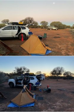
I think the issue occurred because I accidentally used the indicator. It was the first time one had ever been used in a BMW ;)
 
Righto, bumping this TR.

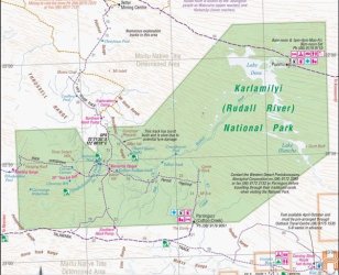
Two years have slipped by, the covid nuttiness is a rapidly fading bad dream and my itch to get to Rudall River NP never really went away. So, about two weeks ago, I set out for a relatively short direct trip to the park, from which I returned on Tuesday.

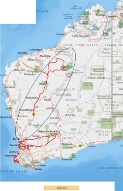
It was a touch over 3500km round-trip. The plan was to be in Newman (1200km) for Tuesday night and a Wednesday morning kick-off into the park.

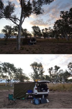
I made a leisurely start on Monday, before reaching a Main Roads WA 24h rest stop about 60km S of Mt Magnet just on 1700h to camp for the night. It was a full moon.

Snip 1.JPG

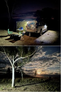
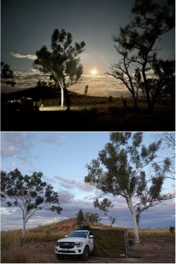
Sunset and moonrise, followed by sunrise the next day.

Snip 2.JPG

I was carrying 60L of extra fuel, but after using almost half a tank getting out to the park, I decided to continue E another 60km to Parrngurr aboriginal community and top up, just to be on the safe side, before returning to enter the park at the southern side.

Continuing E from Parrngurr on the Talawana Track intersects the famed Canning Stock Route (Way into the WA wilderness).

Despite being WA’s largest NP, the authorities do absolutely nothing to promote it as a destination, perhaps because of its remoteness. There are no official signposts to it coming out of Newman on the S side or Marble Bar coming from the N side.

I did notice when exiting near the Telfer gold mine, and for a few km on a road within the mine site lease, there was a home-made sign at a fork, but it was clearly aimed at directing traffic away from mine exploration activities.

Snip 3.JPG

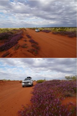
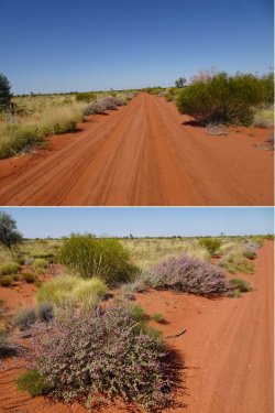
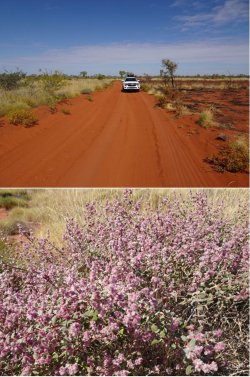
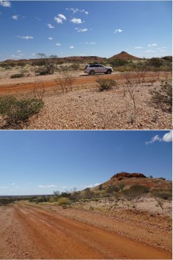
The road outside the park between Parrngurr and the park S entry had a good display of some wildflowers but this season was nowhere near as good as 2021.

Snip 4.JPG

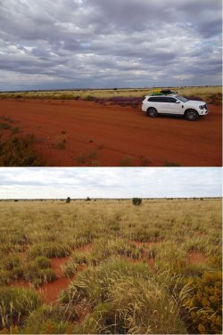
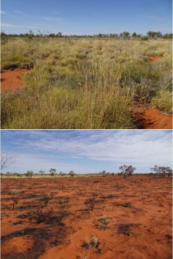
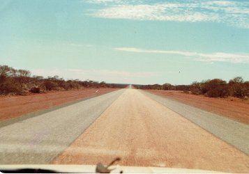
Spinifex as far as the eye can see.

Snip 5.JPG

A few km into the park and a good camping area near an old well, the mechanism of which has been removed.

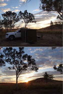
Camp comfortably set up before sunset. Then moonrise and sunrise the next day.

Snip 6.JPG

Snip 7.JPGSnip 8.JPGSnip 9.JPG
 
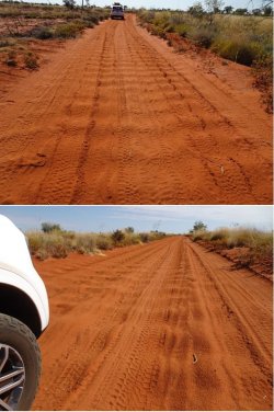
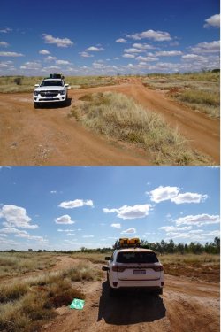
The sandy tracks may look benign at first glance, but the corrugations were fierce. Air-down is essential.

20kph was about the best speed over those sections. Interestingly, the corrugations were fiercer in the S part than in the N, seeming to have a greater distance between peaks and broader peaks. Those in the N could be traversed most comfortably at about 40kph.

Snip 10.JPGSnip 11.JPG

When spinifex burns, nothing remains.

Snip 12.JPGSnip 13.JPG

Stonier ground further into the park.

Snip 14.JPG

Lunch break near the Rudall River crossing and an opportunity to siphon some fuel to start getting some weight off the roof.

Snip 15.JPG

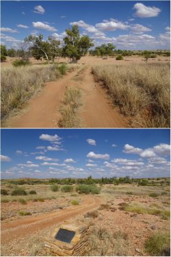
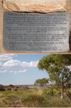
Easy dry riverbed crossing. The coarse sand was firm and not chopped up. On the other side a plaque installed by a police Canning Stock Route expedition in 1994.

Snip 16.JPGSnip 17.JPGSnip 18.JPG
 
Righto, bumping this TR.

Two years have slipped by, the covid nuttiness is a rapidly fading bad dream and my itch to get to Rudall River NP never really went away. So, about two weeks ago, I set out for a relatively short direct trip to the park, from which I returned on Tuesday.

It was a touch over 3500km round-trip. The plan was to be in Newman (1200km) for Tuesday night and a Wednesday morning kick-off into the park.

I made a leisurely start on Monday, before reaching a Main Roads WA 24h rest stop about 60km S of Mt Magnet just on 1700h to camp for the night. It was a full moon.

View attachment 339064

Sunset and moonrise, followed by sunrise the next day.

View attachment 339065

I was carrying 60L of extra fuel, but after using almost half a tank getting out to the park, I decided to continue E another 60km to Parrngurr aboriginal community and top up, just to be on the safe side, before returning to enter the park at the southern side.

Continuing E from Parrngurr on the Talawana Track intersects the famed Canning Stock Route (Way into the WA wilderness).

Despite being WA’s largest NP, the authorities do absolutely nothing to promote it as a destination, perhaps because of its remoteness. There are no official signposts to it coming out of Newman on the S side or Marble Bar coming from the N side.

I did notice when exiting near the Telfer gold mine, and for a few km on a road within the mine site lease, there was a home-made sign at a fork, but it was clearly aimed at directing traffic away from mine exploration activities.

View attachment 339066

The road outside the park between Parrngurr and the park S entry had a good display of some wildflowers but this season was nowhere near as good as 2021.

View attachment 339067

Spinifex as far as the eye can see.

View attachment 339068

A few km into the park and a good camping area near an old well, the mechanism of which has been removed.

Camp comfortably set up before sunset. Then moonrise and sunrise the next day.

View attachment 339069

View attachment 339070View attachment 339071View attachment 339072

Great photos, really gives a sense of the remoteness 📸

How's the Everest handling the conditions?
 
Last edited:
Very well, mate. The previous one was good; this one, if anything, is better.
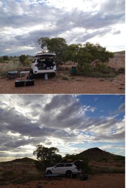
Good to hear mate. We're still very pleased with ours but of course it hasn't been put through its paces like yours at this stage.
 
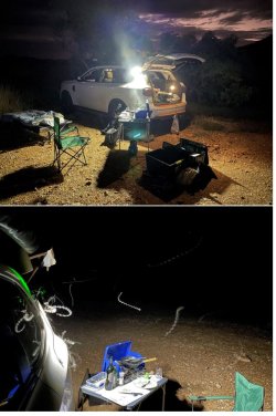
It had been a hot day, reaching about 36deg, and cloud that built up late in the day kept it warm into the night. I found a nice level spot near a couple of pretty trees and set up camp, sleeping in the open.

Snip 19.JPG

The well-ventilated shower suite. Followed by some wine as the sun went down. Blissful solitude!

Snip 20.JPGSnip 21.JPGSnip 22.JPG

The warm night brought good insect activity.

Snip 23.JPG
 
Then turning off the main N-S track onto the track into Desert Queen Baths, the highlight of the park. Traversing the 18km takes about 1.5h. There are quite a few rocky wash gullies. It’s not gnarly technical 4WDing, but they need to be taken slowly.

Snip 30.JPGSnip 31.JPGSnip 32.JPGSnip 33.JPGSnip 34.JPGSnip 35.JPGSnip 36.JPGSnip 37.JPG
 
As I’ve mentioned to you before JM, those are the types of locations and conditions I used to work in. I wouldn’t do it again without a similar pay cheque!!
 

Become an AFF member!

Join Australian Frequent Flyer (AFF) for free and unlock insider tips, exclusive deals, and global meetups with 65,000+ frequent flyers.

AFF members can also access our Frequent Flyer Training courses, and upgrade to Fast-track your way to expert traveller status and unlock even more exclusive discounts!

AFF forum abbreviations

Wondering about Y, J or any of the other abbreviations used on our forum?

Check out our guide to common AFF acronyms & abbreviations.
Back
Top