The 5 Stans of the Silk Road

Status
Not open for further replies.
A final visit to the archaeological museum which i won't cover.

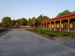
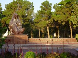
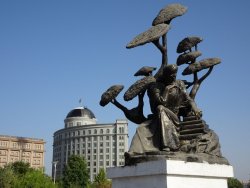
On my morning walk, I passed the local war memorial (Uzbek memorials were de-Russified by order of the President). The 'grieving mother' statue and motif is found all over Uzbekistan. The script in Uzbek and English is "You will always be in my arms, my darling".

DSC04564.JPG

DSC04577.JPG

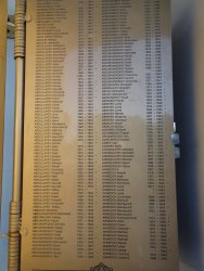
Names of the dead are inscribed on brass pages which can be turned to view,

DSC04567.JPG


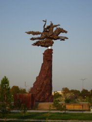
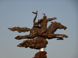
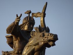
Nearby is a statue to the Uzbek poet and hero Alpamysh.

DSC04569.JPG

DSC04570.JPG

DSC04572.JPG
 
We drove from Termez to Dushanbe, the capital of Tajikistan, yesterday, arriving about 4 pm.

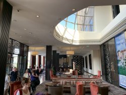
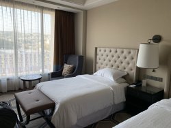
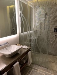
We are staying at the Dushanbe Hilton, the best hotel of the trip, whick also marks the coming series of homestays and yurts! ... and often, lack of wifi for days on end.

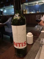
The Hilton was so nice I skiped the TR update!! Had a sensational. in house Asian meal with JohnM, with a very nice Malbec from Argentina. Will cover that in sequence when I resume the TR when internet allows.
 
Am all caught up now - what wonderful photos! I look forward to more :)
 
You won't, unfortunately, get into Afghanistan but if you could, it is by some stretch the most authentic of the Stans. The north is predominantly Tajik but without the Russian influence and has amazing valleys and scenery to boot. Try and get to the Pamirs if you can to experience something very similar.
 
Yes, I've found a tour company that does day trips into Afghanistan from Termez 😊.

Next time looking to do that, plus Turkmenistan again, go through the crater to their NW, into NE Uzbekistan, Tashkent, then maybe the Pamirs. Even the 'lower' mountains of Tajikistan today were breathtaking.

Have only slow wifi, so will catch up this TR in a week or so as we are heading into'homestay' and 'yurt stay' in Kyrgyzstan for the next little while.
 
The tour ended this morning and I'm cooling my heels in Almaty, Kazakhstan for a few days until I fly to Seoul. Forecast is for rain tomorrow, so I might make some progress in updating the TR.

It was unintentionally significant that I broke the TR in Termez. Up to then , it was the '4 Ms' - mosques, madrassas, mausoleums and monuments. And it was hot.

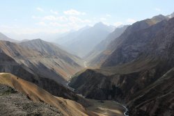
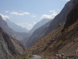
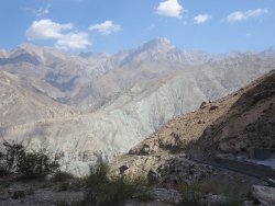
Since then its been mountains, canyons, lakes and rivers, and its been cool to cold. We've stayed a couple of nights at 3,000m in a yurt camp (Cusco is 3,400m) and gone over passes of 3,400m. Bumped over hours of rough dirt roads to reach some very isolated spots. Fantastic stuff.

Zillions of photos to sort ... I'll get back as soon as I can. Here are a couple of teasers (pics as shot -no enhancements!)

DSC04852.JPG

DSC04860.JPG

These two are by fellow-tripper Siobhan, as I didn't have my Sony available for these dramatic scenes:

We drove up the slopes from the bottom of the valley:

IMG_0144.JPG

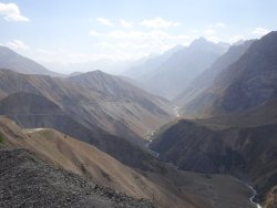
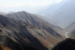
And continued from the far end of this valley following the road on the left side ...

IMG_9829.JPG
 
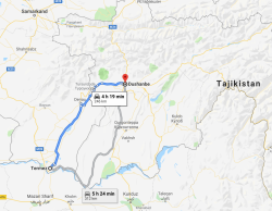
Now, where the hell was I? Oh, yes. We left Termez in southern Uzbekistan and were heading for Dushanbe, the capital of Tajikistan.

1568000976151.png

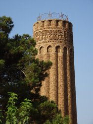
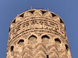
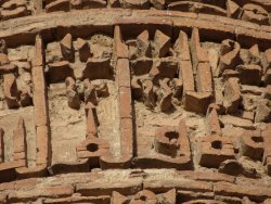
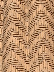
First stop was Jarkurgan, where we visited a 22m high minaret at Minar, built in 1108, and one of the oldest surviving in the world. Also a little unusual for its scalloped sides.

DSC04674.JPG

IMG_5232.JPG


DSC04672.JPG

IMG_5230.JPG

At the border with Tajikistan, we said goodbye to our excellent local Uzbek tour leader, and, escorted by our continuing 'western' leader, we began the border crossing, the most difficult of all, at least physically. After clearing Uzbek immigration (where we had to submit each hotel's registration forms - failure to do so would mean trouble, or at least a considerable delay), we walked ourselves and our bags the 1km or so across 'no man's land' to reach the Tajik side. Fortunately it wasn't too hot, still being late morning and even though it was slightly up-hill, it was paved and not too demanding.

Clearing Tajik immigration and customs (X-rays of bags and possibility of questions - one of the group got asked about carrying 'drugs', I got asked if I was carrying a drone) - we made it to out third 'Stan' and were met by our country leader, a very friendly young bloke whose wife, we discovered later, was just about to give birth!

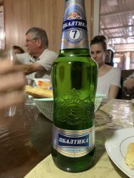
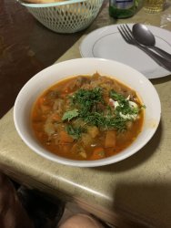
Onto a slightly smaller coach than in Uzbekistan, we proceeded towards the capital, Dushanbe, an Arabic word meaning 'Monday'. But lunch on the way - beer of course (Russian - Baltica) and for me a nice soup. The soups were always a good lunch option.

IMG_5248.JPG

IMG_5249.JPG
 
Dushanbe is the capital of Tajikistan, named 'Monday' in Arabic as it grew from a village that had a popular market on Mondays. Today its a modern city of about 800,000 people. From 1929 to 1961 it was called by the Soviets Stalinabad.

We had it explained (several times) the differences between Takiks and Uzbeks, but it escapes me now. Ethnically and linguistically different, but to a westerner, its subtle. There are 'enclaves of Uzbekistan and Tajikistan within the other's territory. Here, unlike Uzbekistan, they have retained the Cyrillic script, so it all looks 'Russian', but isn't.

Tajikistan has had a long and complex history. As Wikipedia says, it has been part of the Achaemenid Empire, Sasanian Empire, Hephthalite Empire, Samanid Empire, Mongol Empire, Timurid dynasty, the Khanate of Bukhara, the Russian Empire, and subsequently part of the Soviet Union. :eek: Tajikistan was made an autonomous region of the Uzbek Soviet Socialist Republic in 1924 but in 1929 it was made a separate republic within the USSR. It became independent in 1991 in the break-up of the USSR.

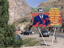
Almost immediately upon independence a civil war broke out, it seems mainly clan-based. About 100,000 died and over a million refugees were created (mainly ethnic Russians who returned to Russia) before a UN brokered cease-fire was achieved in 1997; the country was devastated. The current President was elected then, and had been 're-elected' since, with very large majorities ;). Its an authoritarian state, have no doubt; the media is censored. The President's image is everywhere. :rolleyes:

Tajikistan has a population of about 9 million and is 90% mountainous. There is a continuing threat from Islamic militancy and a number of incidents have occurred in the highly mountainous east of the country. It seems OK now; tour groups go through there.

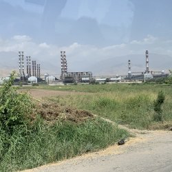
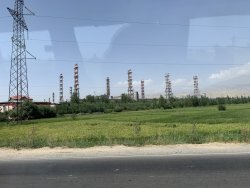
Half the country's GDP comes from Tajiks working in Russia (in fact ALL the Stans have considerable percentages of their working population working in Russia). Other industries are aluminium and cotton. The aluminium industry was established by the Soviets. The Tajiks have no bauxite to mine but do have water for hydro power. We padded an enormous aluminium smelter shorty after crossing the border. Its not on a port, or near a river, so both the source material and the power have to be brought in overland. Classic Soviet planning.
IMG_5246.JPG

IMG_5247.JPG

As in the other Stans, the Soviets harnessed the massive rivers flowing out of the Tajik mountains to establish cotton growing. there are canals everywhere and flood irrigation is used. Its this water usage - and wastage - that consumes the water that used to feed the Aral Sea in northern Uzbekistan / southern Kazakhstan. The Aral Sea has become a true environmental disaster and had now mostly dried up.

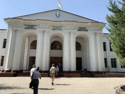
First stop in Dushanbe is the historical museum.
IMG_5255.JPG

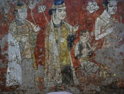
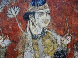
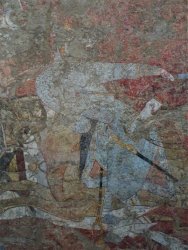
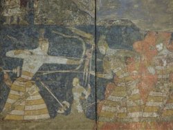
A few things from the museum. Panjakent is in the far west of the country and was a flourishing town on the silk road in the 5th-8th centuries AD. A Soviet archaeologist worked for 50 years on the site, protecting it even through the civil war. Some of the frescoes have been relocated to the Museum in Dushanbe.
DSC04724.JPG

DSC04726.JPG

DSC04695.JPG


DSC04720.JPG

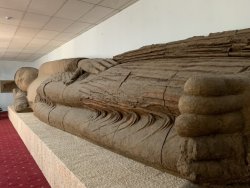
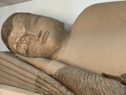
Again, not leaving out the Buddhist history of the region, demonstrating the reach of the Silk Road from the far east. At Ajina-Teppa, in the south-west of Tajikistan, a 5th Century monastery was discovered in 1959 with a 13m long reclining Buddha, or 'Buddha in Nirvana', made of baked clay (the largest Buddha of clay). It had been broken by Islamists a few centuries after its creation. The Dushanbe museum now houses the statue, with relocation partly funded by the USA and Japan. It was cut into pieces by Tajik archaeologists and is not the central display of the museum. The plain brown parts are restoration of the destroyed parts.
IMG_5262.JPG

IMG_5263.JPG
 
After the museum we were dropped off in the centre of the city for a walk through so,me of its many gardens. Its a very green and pleasant city - and without an 'old town', well laid out.

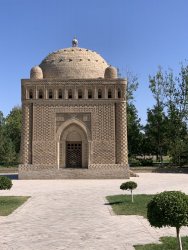
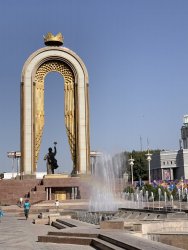
After the fall of the Soviet Union, we were told, each of the 'Stans adopted a local hero to replace Lenin & co. In Uzbekistan it was Timur (Tamerlane). Here in Tajikistan it was Ismail Samani, or Isma'il ibn Ahmad. In the late 850s he was the conquering Emir of 'Transoxiana' covering from Kabul in present day Afghanistan, Tajikistan, Bukhara in Uzbekistan to the north-west and into Iran to the south-west. Most of the area of the tour.

We saw his beautiful little mausoleum in Bukhara, and when our guide pointed this out, a bunch of light bulbs went off in the tour group, as some of the very complex history of the region came together across current country boundaries. :)

IMG_4690.JPG

The Tajiks have named their currency after him - the Somoni and his image is on the largest bank note. They re-named the highest peak (7,500m) from 'Communism Peak' to bear his name. And here he is, in the center of Dushanbe:

IMG_5271.JPG

IMG_5269.JPG

DSC04741.JPG

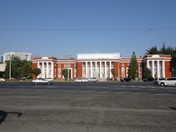
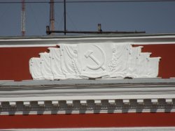
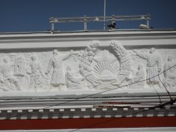
Opposite him is the old Parliament building, still with communist symbols of the past.

DSC04735.JPG

DSC04738.JPG

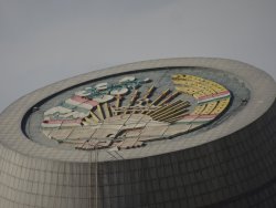
This shows the national emblem of Tajikistan, featuring the sun, sheaves of wheat etc, with the communist overlays


DSC04736.JPG

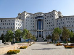
In the same vicinity is the national library:

DSC04748.JPG

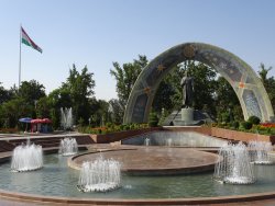
.. and a statue of their poet, Rudaki, born 1859, known af the 'Adam of Poets', or the founder of classic Persian literature. Behind him is the new Parliament building (just a peek - direct photos not allowed)

IMG_5272.JPG

DSC04752.JPG
 
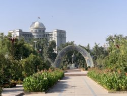
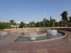
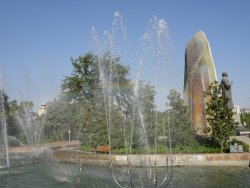
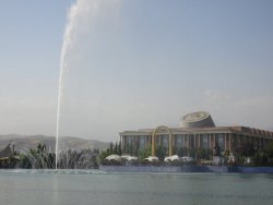
The central park is large with plenty of trees, fountains and human sculpture.

DSC04755.JPG

DSC04757.JPG

That's a new museum building in the back-ground, with the modern Tajik symbol on it.

DSC04762.JPG

DSC04764.JPG

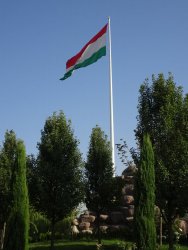
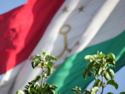
There is another Very Big Flagpole, with another Very Big Flag (was the world's second biggest, but may have dropped down the ladder now):

DSC04768.JPG

Something to remember at the next Olympics.

DSC04769.JPG

Statue of Tajik doctor and scientist Ibin Sina (980-1037), who went to the west as Avicenna and according to Wikipedia:

... was a Persian Muslim polymath who is regarded as one of the most significant physicians, astronomers, thinkers and writers of the Islamic Golden Age, and the father of modern medicine. Avicenna is also called "the most influential philosopher of the pre-modern era". Of the 450 works he is believed to have written, around 240 have survived, including 150 on philosophy and 40 on medicine.

We were told that his name was the root of the word 'medicine', but this article (opens a PDF on the word's etymology) doesn't recognise the Persian.

DSC04772.JPG
 
A word about Tajikistan society, that we could see in our 3-4 days there. Like all the other 'Stans, its Muslim predominantly and perhaps a little more observant than the others, at least in the city, but generally a very relaxed form of Islam. We saw some ladies in Islamic veils, mostly colourful and many in scarves worn casually. Also many women without, and in 100% western clothing.

Lots of booze about, sold and consumed freely. Few mosques in evidence, but we did pass a large one which I think was being built with Saudi money, which our country guide disapproved of.

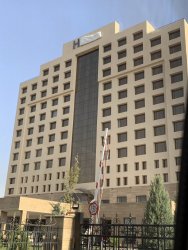
Next stop the Dushanbe Hilton (formerly Sheraton), the best hotel of the trip :) and we were told to take every advantage of it, as accommodation hereafter would be a step down from that to date - home stays, yurts and basic hotels. Note the Hilton sign still being put up:

IMG_5284.JPG

IMG_5285.JPG

IMG_5286.JPG

IMG_5287.JPG

A bit of consternation when we found that the main 2 restaurants in the place were closed for a private function 🤬 (I expressed my great dislike for hotels that do this - 'sell' their facilities to punters who book, then deny them the amenity when they arrive).

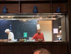
Had a silver lining though. JohnM and I had dinner at their Asian restaurant, and it was a treat.

IMG_5290.JPG

No pic of the food, sorry, but we had a nice Argentinian Malbec (I think Tajik wines were lacking ...)

IMG_5289.JPG

A nice refreshing night at the Hilton before the change of pace the next day.
 
What a day!

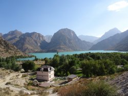
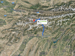
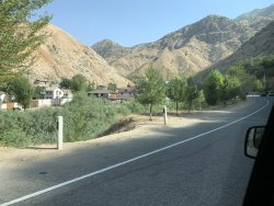
We headed immediately out of town, bound for the mountains and our overnight stay at Lake Iskanderkul. This is the main highway between the capital and the second largest city, Khujand and has heavy traffic. PS you can always ignore the Google drive times - the roads and the traffic can double the times, or more.

1568032070102.png

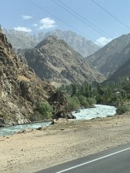
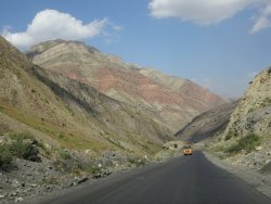
We soon were driving up a river, lined with dachas including the Presidents. This soon gave way to a gorge, which continued for some time. We experienced the 'joys' of Tajik drivers, overtaking crazily (single lane each way), relying on the on-coming and overtaken traffic to 'squeeze' out to the side to avoid head-ons. We had shifted to 4 mini-vans, as a coach couldn't handle the roads and inclines where we were headed. 😳 The water was a fantastic turquoise, reflecting the mountain glacier origins of the flow (like in the Rockies in Canada).


IMG_5300.JPG

Yes, we are headed up there, and then some!!

IMG_5304.JPG

IMG_5306.JPG

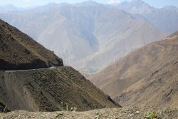
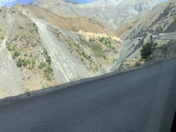
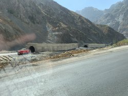
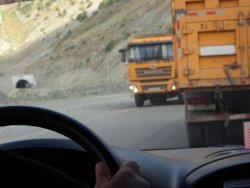
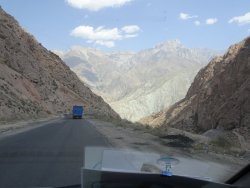
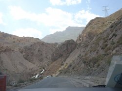
On we rolled up the gorge, which eventually gave way to us climbing up the 'lower' slopes of the mountains. Lots of hairpins, and anti-avalanche tunnels. Lots of trucks on the road, as its the main transport corridor of the nation.

IMG_5309.JPG

IMG_5310.JPG

DSC04792.JPG

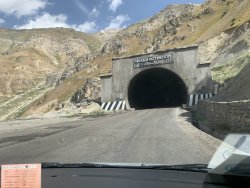
We were climbing towards the infamous 'Iranian tunnel' 😳😱 at 2,700m, but had plenty to contemplate before we reached it.

IMG_5311.JPG

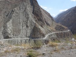
That;s the road clinging to the RH side of the mountains:

IMG_5314.JPG

DSC04793.JPG
 
Last edited:
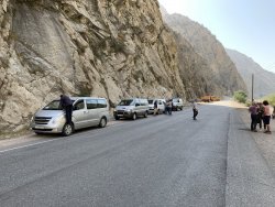
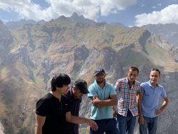
A photo and toilet stop. This is our country guide 'Bek' on the left and our 4 'fearless' drivers (they were pretty good). We later learned that Bek's wife was about to go into labour soon after ..

IMG_5324.JPG

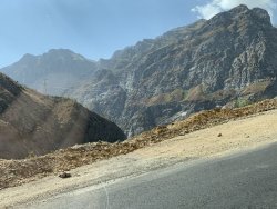
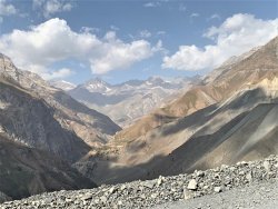
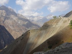
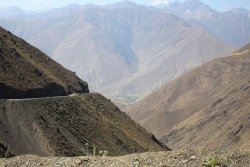
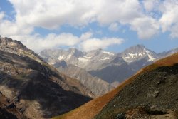
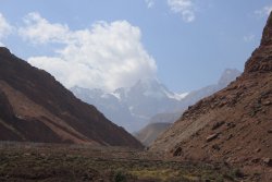
A few snaps as we made our way up - but really, we are just in baby mountains - the higher Tajik mountains are away to the south-east.

The road is along the LH side:

DSC04795.JPG

IMG_5320.JPG


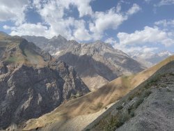
These were taken by Siobhan, one of our group who has a better eye for photography (and a better camera) :). The valley far below in the distance was between 2 sets of ranges we climbed and descended. This is the end of summer. Imagine the snow etc in winter!! The road is kept open during winter, but I sure wouldn't travel it then.

IMG_0144.JPG


IMG_9833.JPG

IMG_9837.JPG

IMG_9867.JPG

Next .. (cue sinister music) ... the 'Iranian tunnel'.
 
I was blissfully unaware of the 'Iranian tunnel' until our western leader started making references to it during the day as one of the 'highlights' of the drive.

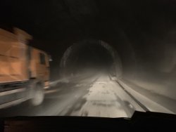
The 5km long Anzbob tunnel was built for the Tajiks by the Iranians and opened in 2006 despite not being finished. It soon got a reputation for being one of the most dangerous road tunnels in the world. It was ultimately finished during 2014/15 and re-opened. It saves about 4 hours driving over the high mountain pass and avoids a transit of Uzbekistan, who sometimes closed the road.

It is unlit, unventilated, as as far as I could tell in the gloom, not much support inside. 😱😱😱

IMG_5325.JPG

IMG_5327.JPG

Didn't stop trucks overtaking, of course.

IMG_5326.JPG

What goes up, must go down :) 😳

DSC04805.JPG

DSC04808.JPG

DSC04814.JPG

DSC04812.JPG

DSC04816.JPG

DSC04810.JPG

But don't worry, be happy - El Presedente looks out over all! (Its either him smiling, or him in a hard hat ...)

IMG_5342.JPG
 
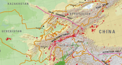
What JohnM doesn't know about geology and rock mechanics won't hurt him, 🙄 but the engineering of these roads, with slopes parallel-to-cleavage, lack of ground support on the up-slopes, let alone in the tunnels, left me with just a faint sense of apprehension until we were out of it, especially knowing that we were on the geological equivalent of a nuclear bomb testing range ... (the dots below are just the origins of historical earthquakes ... the shaking thingy spreads out for quite a way each time! 😱 )

1568039117584.png

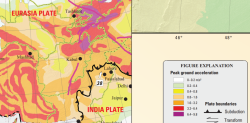
This next diagram is a bit technical, but 'peak ground acceleration' basically means the higher the number (or colour, up to purple), the more the world will basically end for you if it goes off (let alone clinging to the side of a mountain). This is historical risk, and where we went on this highway is neatly between Tashkent and Kabul ... red-purple :eek:

1568039476762.png
 
Dushanbe is the capital of Tajikistan, named 'Monday' in Arabic as it grew from a village that had a popular market on Mondays.

We had it explained (several times) the differences between Takiks and Uzbeks, but it escapes me now.
 
Australia's highest-earning Velocity Frequent Flyer credit card: Offer expires: 21 Jan 2025
- Earn 60,000 bonus Velocity Points
- Get unlimited Virgin Australia Lounge access
- Enjoy a complimentary return Virgin Australia domestic flight each year

AFF Supporters can remove this and all advertisements

Dushanbe is the capital of Tajikistan, named 'Monday' in Arabic as it grew from a village that had a popular market on Mondays. Today its a modern city of about 800,000 people. From 1929 to 1961 it was called by the Soviets Stalinabad.

We had it explained (several times) the differences between Takiks and Uzbeks, but it escapes me now. Ethnically and linguistically different, but to a westerner, its subtle.

Not to me. I found the difference between Tajikistan and the other Stans to be stark. It's a Persian-speaking island surrounded by a Turkic sea (Dushanbe is Persian for Monday, not Arabic) and so has a feel that resembles Iran. The people are also not asiatic in appearance like their Turkic neighbours (and whose language is mutually intelligible with Turkey's Turkish). In fact I recall seeing a lot of blue eyes and the odd blonde (and who weren't ethnic Russian). As a result of Tajikistan's separateness it has appalling relations with its neighbours. It fueds regularly with them and has come close to outright hostilities. The other fascinating footnote is the populations of Bukhara and Samarkand were (and I think still remain) overwhelmingly Tajik, a reminder of the country's once grand past.

Thanks for the pics!
 
Status
Not open for further replies.

Become an AFF member!

Join Australian Frequent Flyer (AFF) for free and unlock insider tips, exclusive deals, and global meetups with 65,000+ frequent flyers.

AFF members can also access our Frequent Flyer Training courses, and upgrade to Fast-track your way to expert traveller status and unlock even more exclusive discounts!

AFF forum abbreviations

Wondering about Y, J or any of the other abbreviations used on our forum?

Check out our guide to common AFF acronyms & abbreviations.
Back
Top