WA WAnderings

A short interpretive trail showing the characteristics of jarrah, marri and karri. Karri is clearly different from the other two which are superficially similar, but once the difference is pointed out it is easy to distinguish between them.

Snip 31.JPGSnip 32.JPGSnip 33.JPGSnip 34.JPGSnip 35.JPGSnip 36.JPGSnip 37.JPG
 
Moving on to Black Point.

The sandy track winds through some nice bush.

Snip 38.JPG

Black Point is the main peninsula directly below the facilities, with basalt ‘stepping stones’, but the very much taller columnar basalt formation around the bay is a more prominent single object.

Snip 39.JPGSnip 40.JPGSnip 41.JPGSnip 42.JPGSnip 43.JPG
 
Snip 44.JPGSnip 45.JPGSnip 46.JPGSnip 47.JPG

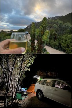
And of course, the mandatory sundowner with the sun setting over the ocean in accordance with the true order of nature. 😜

Snip 48.JPG

Solitude in the campground, so I snared a spot near the picnic tables. Next morning, I packed up and then had breakfast overlooking the bay on a glorious morning. Divine!

Snip 49.JPG
 
Bump.

There have been good rains across SW Australia this winter, and spring is now in the air. So a few sunny days earlier this week had me heading into the northern agricultural region and the adjacent rangeland of the lower Murchison River region to scope a couple of areas I’ve been past plenty of times but not stopped to see.

Those areas were Karara Rangeland Park: Karara Rangeland Park and Coalseam Conservation Park: Coalseam Conservation Park.

In a nutshell, Karara Rangeland Park is six former pastoral stations that have been resumed to form the reserve. The region was once an area of major sheep-grazing on native vegetation, but land degradation through past over-stocking and generally poor economics of the wool industry had the industry declining before wild dogs signalled its death-knell. That story plays out widely across the Australian southern and western rangeland pastoral belt.

Coalseam is a cutaway area in the Irwin River Valley that showed indication of coal and was reserved in the mid-1800s. The coal was uneconomic and the land was too rugged for agriculture, so fortunately the reserve remained.
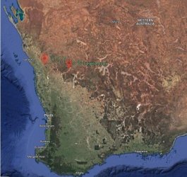
Snip 1.JPG

I decided to stay at Mellenbye Station Stay: stationstaymellenbye. We had stayed there just overnight last year on our way north to Karajini NP and beyond (From post #15: A Western Swing – Wildflowers, Gorges, Coast) and really enjoyed it. Plenty of accommodation options and some quirky features. Highly recommended and a great base for scoping the rich wildflowers of the region.

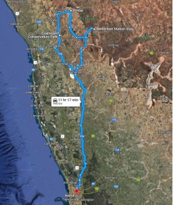
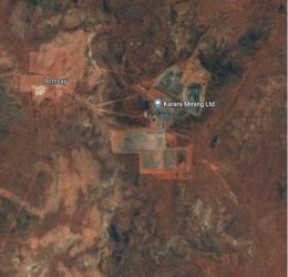
The overall backbone of the route was roughly like this, with a lot of driving backroads and tracks not shown. Karara Rangeland Park is to the SE of Mellenbye, surrounding where ‘Rothsay’, an historic location, is marked on the map.

There is the primarily magnetite Karara iron ore mine near Rothsay, but I found it impossible to get close enough to even see it, apart from the railway that goes to Geraldton.
Snip 2.JPGSnip 3.JPG

OK, I hit the road on Sunday morning. Mellenbye direct is just under a 5h run from Perth, but I had a few stops along the way.

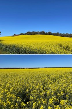
Canola looking brilliant. Although, mind you: Canola Farmers Welcome "Get the Fark Off Our Property" Season - The Bell Tower Times

:p

Snip 4.JPG

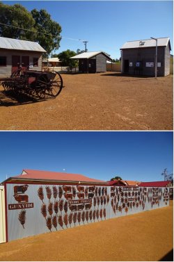
A lunch stop at the small town of Coorow. It has a tidy little museum.
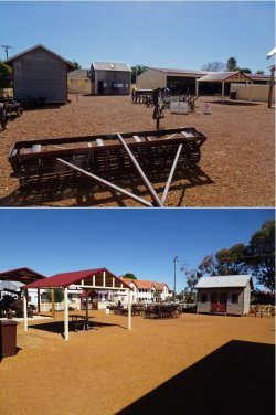
Snip 5.JPGSnip 6.JPGSnip 7.JPG

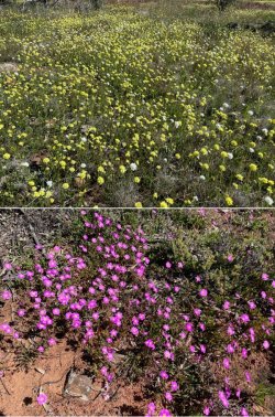
Some wildflowers in the area.

Snip 8.JPG

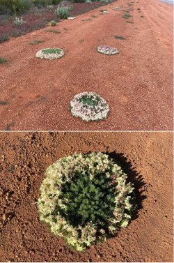
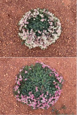
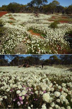
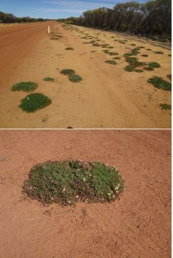
Pressing on to a stop north of Morawa where I know wreath flower, Lechenaultia macrantha, occurs. It is somewhat of a holy grail for WA wildflower seekers. The trick is getting to an area when they are at peak flowering.

A little too early at my first stop and the plants there were fairly small.
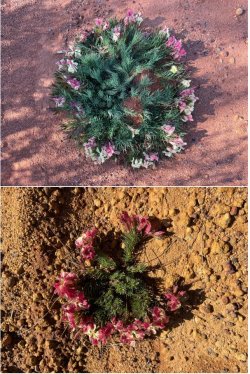
Snip 9.JPG
 
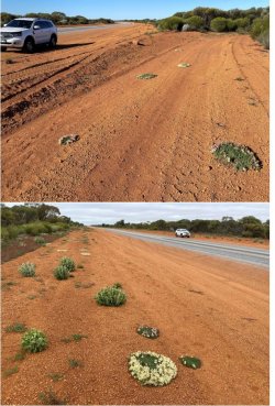
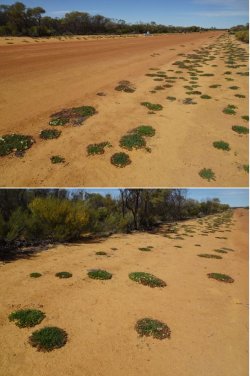
But - since last year there has been some roadwork around the Mellenbye entry and disturbed soil is the favoured habitat for wreath flower. Some cracking examples.

Snip 10.JPGSnip 11.JPGSnip 12.JPG

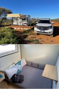
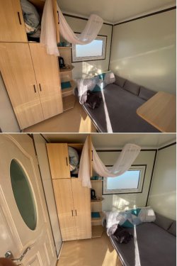
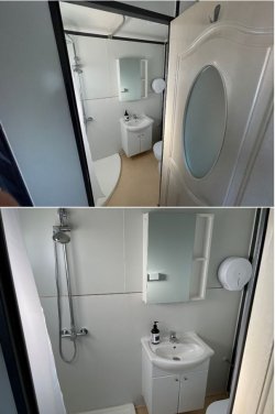
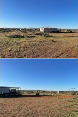
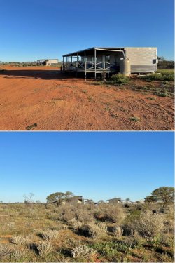
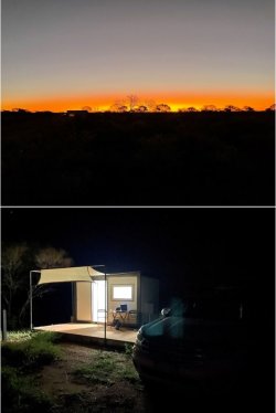
On to Mellenbye. I opted for a ‘pod’, a cabin with bed and ensuite, with a deck facing west to watch the sun go down. They are a new addition in the last year. Neat, clean and cosy. Some people with caravans pull their van up next to a pod so that they have their own ensuite.

I could have pitched a tent in the campground and used the camp kitchen, but I wanted to check out the pods. Besides, it’s cold out there at this time of year!

Each pod has tea/coffee making gear. I took my gas camp stove and set it up on the table on the deck and cooked dinner each of the two nights I was there.

All the various accommodation units are well-separated, so it was perfectly quiet at night. Tranquillo.

Snip 13.JPGSnip 14.JPGSnip 15.JPGSnip 16.JPGSnip 17.JPGSnip 18.JPGSnip 19.JPG
 
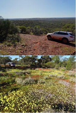
That covered the NW section of the park and I drove into Morawa for fuel and lunch, before heading south to Perenjori and a check of another wreath flower site (still a little too early for best flowers) before re-entering the park to loop though the SW section. Two or three days would be required to cover out to the E side of the park.

Snip 37.JPGSnip 38.JPGSnip 39.JPGSnip 40.JPGSnip 41.JPG
 
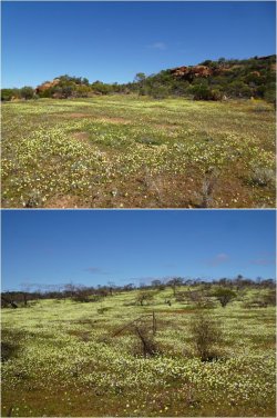
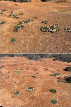
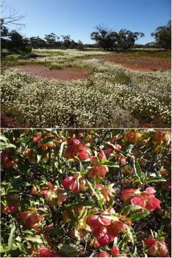
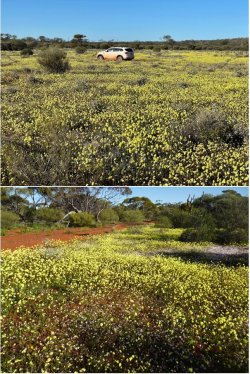
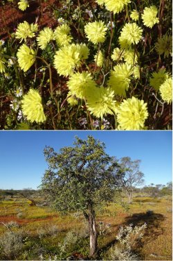
I particularly like the yellow everlastings.

Snip 42.JPG

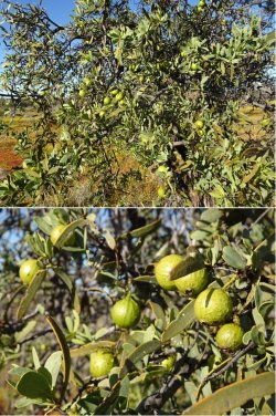
And a native sandalwood (Santalum spicatum) tree in fruit.

Snip 43.JPGSnip 44.JPG

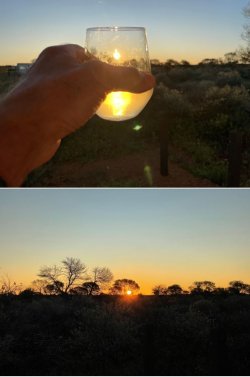
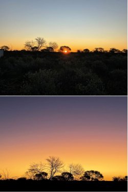
Then back to Mellenbye after an excellent day for more sunset viewing over a glass or two of wine.

Snip 45.JPGSnip 46.JPG

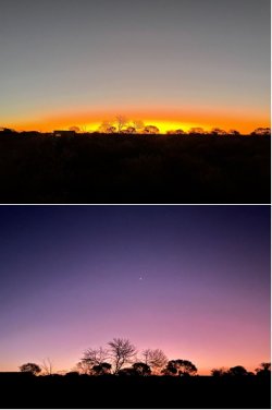
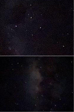
Later, under a huge, clear sky. The Southern Cross and Milky Way by iPhone. Darned if I know what those amateurs at the James Webb Space Telescope are toying with…🧐😛

Snip 47.JPG
 
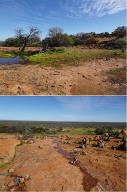
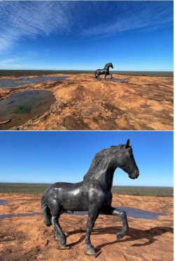
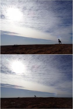
Next morning, before leaving Mellenbye, I drove the c. 20kms out to Wollanoo Hill at the eastern end of the station. They colloquially refer to it as ‘The Rock’.

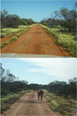
They run some cattle on the station. Unsurprisingly, they were looking in tip-top condition.

Snip 48.JPGSnip 49.JPG

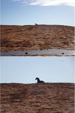
In keeping with the quirkiness of Mellenbye (posts #15-17: A Western Swing – Wildflowers, Gorges, Coast) a statue of a horse adorns the rock. It’s shown on the Mellenbye website without explanation and I didn’t have time after coming back to try to track down Shelly, the owner, for one.

Snip 50.JPGSnip 51.JPGSnip 52.JPGSnip 53.JPGSnip 54.JPGSnip 55.JPG

I departed Mellenbye and headed for Pindar, once a thriving railhead town for the Wool Wagon Pathway (The Wool Wagon Pathway - Outback Pathways) but now just a grain delivery point.

There is a well-known site for wreath flowers nearby. Again, I had driven past there numerous times over many years but never detoured to the flower site, about 12km north of Pindar.

It is so popular that a separate parking lane has been made about 50m to the side of the road where the wreath flowers occur, to avoid a parking scrum on the road verge.

It’s a very large colonisation on both sides of the road, but it was too early for best flowering.

Sadly, there is always a retard who doesn’t look or care where they are driving. :mad:

Snip 56.JPGSnip 57.JPG
 
Turn business expenses into Business Class! Process $10,000 through pay.com.au to score 20,000 bonus PayRewards Points and join 30k+ savvy business owners enjoying these benefits:

- Pay suppliers who don’t take Amex
- Max out credit card rewards—even on government payments
- Earn & Transfer PayRewards Points to 8+ top airline & hotel partners

AFF Supporters can remove this and all advertisements

The old Pindar Hotel is one of only a handful of remaining buildings.

View attachment 290012

Pressing on to Coalseam Conservation Park. The Irwin River cuts into the landscape, with its surrounding agriculture.

View attachment 290013View attachment 290014View attachment 290015View attachment 290016View attachment 290017View attachment 290018View attachment 290019View attachment 290020

That was it and I beelined for home.
Enjoyed the flower photos. Perhaps the horse statue creators were fans of Fury a long, long time ago.

The river levels at Coalseam look about the same as we saw 2 months ago. But a slight, alright huge, difference in the wildflowers.
 
Come the middle of February, the madness of the Christmas/New Year period has subsided, schools have gone back, PJM has returned to work, my elder son and his wife have had their first child. Time for me to get on the road to clear some cobwebs out of my head and blow them out of my vehicle’s turbos.

So, a quick trip departing Sunday of last week and back Tuesday night, in time for PJM and me to have our regular coffee or lunch date on her day off on Wednesdays.

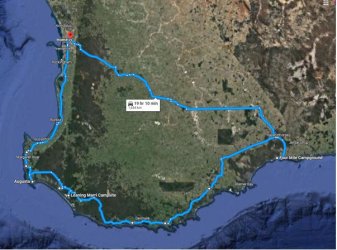
It’s summer, so heading S is the go. There are a couple of spots I want to check out on the lower SW coast, but first a swing out SE to Fitzgerald River National Park for the first night, camping in the DBCA (WA Department of Biodiversity, Conservation and Attractions) Four Mile Campground. A whole $9 for a struggling senior. Good facilities (hot shower, good drop toilets, camp kitchen).

Snip 1.JPG

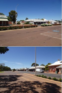
First stop mid-morning at Wickepin, a tidy little town. Quiet at the best of times; positively sleepy on a Sunday morning.

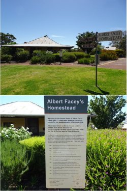
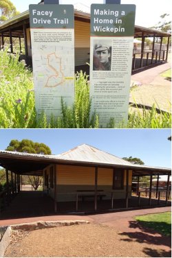
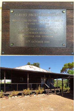
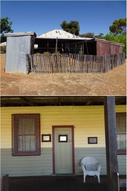
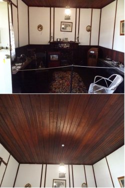
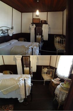
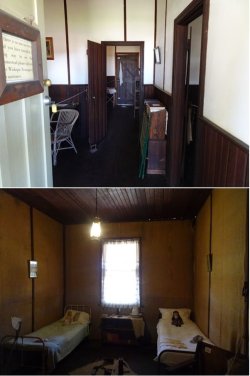
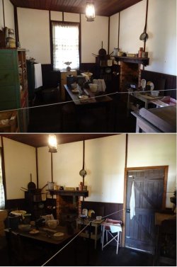
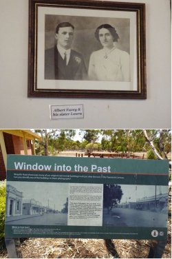
Right in the centre of town is the homestead of Albert Facey (of ‘A Fortunate Life’ fame. Albert Facey - Wikipedia), relocated into town from the farm where it stood.

Snip 2.JPGSnip 3.JPGSnip 4.JPGSnip 5.JPG

The thing that really got my attention was the stunning jarrah ceiling. Some walls were covered in a loose hessian.

Snip 6.JPG
 
Snip 7.JPGSnip 8.JPGSnip 9.JPGSnip 10.JPGSnip 11.JPG

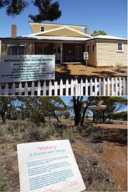
Moving on to Lake Grace and a stop for lunch on the outskirts of town and to scope the Australian Inland Mission Hospital museum (not open). As with many towns in WA, I’ve driven through or stayed overnight in Lake Grace many times during working life but seldom had the time to check out things like this.

Snip 12.JPG

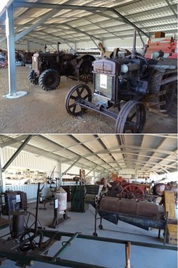
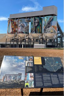
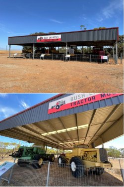
Quick stop to get a pic of the silo art at Newdegate, then the farm-built machinery museum at Lake King. Then a right turn towards the S coast.

Snip 13.JPGSnip 14.JPG
 
My mother came from Wickepin so we went back there to have a look. I worked in Miling, Piawanning, Bindi Bindi and Doodlakine almost 60 years ago as a CBH weighbridge officer and sometimes bin attendant. @JohnM I really should go and revisit once I am retired.
 
Fitzgerald River NP – the site of the Firebomber crash last month. Except for the bitumen roads around the main coastal scenic and recreational area, the internal roads on the E side of the park remain closed following the fire and crash as clean-up operations are still in progress.

I checked into the campground and went for a brief drive before coming back to set up for the night before dark. It was then up to the Barrens Lookout for a sunset drink.

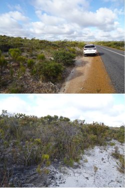
The vegetation is largely shrubby, with sandy soil on the plain that forms the bulk of the park. The park is a significant internationally recognised biosphere reserve owing to its richness of endemic flora, in particular.

Snip 15.JPGSnip 16.JPGSnip 17.JPG

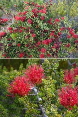
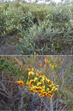
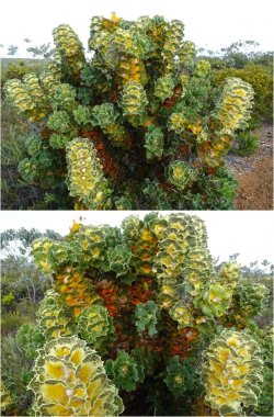
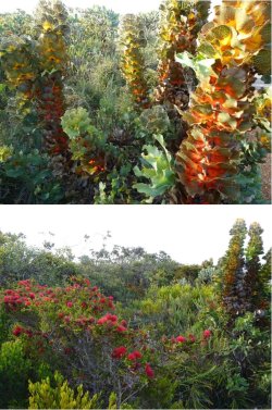
Royal hakea (Hakea victoria).

Snip 18.JPGSnip 19.JPG

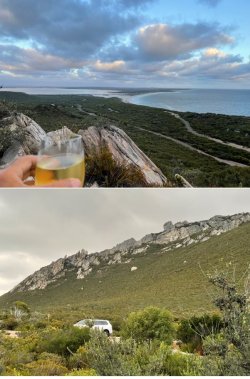
The Barrens lookout.

Snip 20.JPGSnip 21.JPG
 
Next morning, have to drive back through Hopetoun and Ravensthorpe to get back to South Coastal Highway to head west, rather than cutting through the park on Hamersley Drive. Culham Inlet is an important wetland habitat. E Mt Barren in the background.

Snip 22.JPGSnip 23.JPG

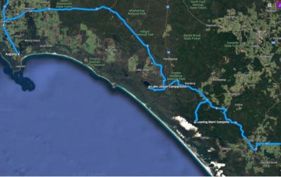
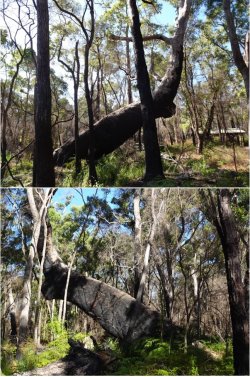
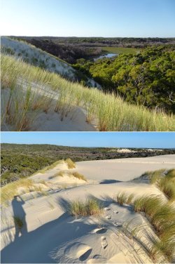
Continuing on to the aptly named Leaning Marri Campground near the foot of the advancing Yeagarup Dunes. Monday night and I was the only person there. It’s a pleasant campground and day-use facility with good drop toilets but no showers. No problem; I have a 60L water tank that fits nicely in the back of my vehicle and a pumped shower that I run off a Li battery pack.

Snip 24.JPGSnip 25.JPG

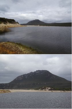
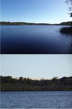
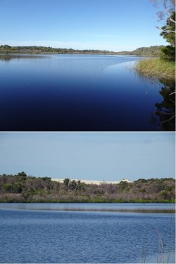
Yeagarup Lake with Yeagarup Dunes in the SW distance, late afternoon.

Snip 26.JPG

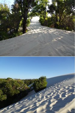
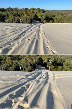
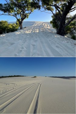
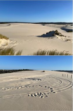
There is a good gravel road into Leaning Marri, but heading to the dunes, 1.5 km away, is on soft sand. Air down tyres essential. I started by dropping mine to about 24psi. Fine for the track to the foot of the dunes, but I only got about 2/3 the way up the slope before coming to a standstill. It was getting late in the day, so I backed out.
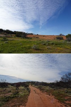
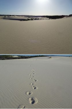
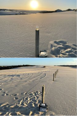
Parked the car and walked up onto the dunes. The aeolian sand is very fine and soft; it has a really nice feel. After walking around up on the dunes for a while, I went back to set up camp, before going back to walk up again with wine and nuts to watch the sunset.
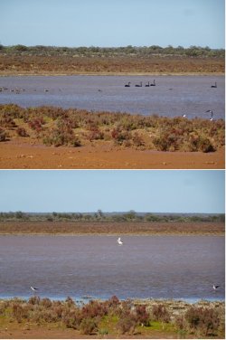
I had no sooner got to the top when my car alarm sounded. What the…?! 🤨

Dashed back down; nobody around. Opened the car and there’s a large moth, an unusual species that I had seen fluttering around the night before, flapping around against the windscreen. :rolleyes: The Lurking Lepidopteran had obviously settled in my vehicle the night before and hitched a ride from Fitzgerald River NP. With the onset of dusk, it had become active and set off the motion sensors. I grabbed the offender and cast it adrift in a new home. :mad:

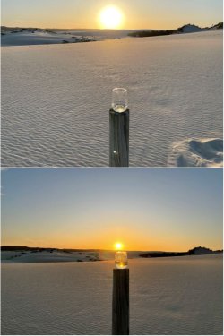
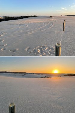
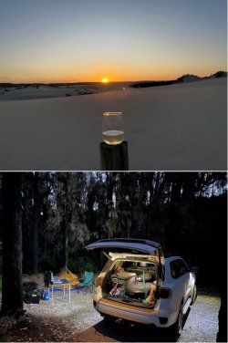
OK, another walk back up through the soft sand to the top of the dunes. Then blissful solitude as the sun went down, continuing into the night as the sole inhabitant of the campground. Sometimes it is pure joy to be by oneself in a serene, isolated location.

Snip 27.JPGSnip 28.JPGSnip 29.JPG
 
Snip 30.JPGSnip 31.JPGSnip 32.JPGSnip 33.JPGSnip 34.JPGSnip 35.JPGSnip 36.JPG

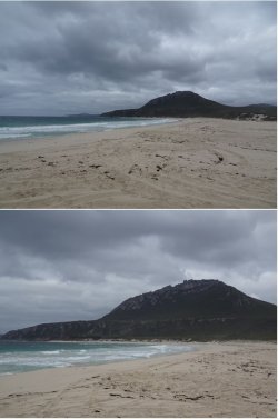
Yeagarup Lake in the morning. I aired down to 14psi and tried the dunes again, hoping the lower pressure and cool sand would work in my favour. Two goes and defeated, but not really trying very hard as I didn’t want to spend a lot of time messing about. If I’d been there for a couple of days I would have worked on it a bit harder.

It was difficult to get a good run-up as the track curved and there wasn’t a decent straight firm ‘runway’ to get some decent momentum. I could have tried airing down more and crawling up but it would have consumed too much time. Another time for that little challenge, as once on top it looked like plain sailing through to the beach.

It wasn’t a problem of getting hopelessly bogged; just sinking too far into the soft sand and bottoming out. I didn’t need to get out the MaxTrax or the shovel; I just pushed the floury, light sand away from the back of the tyres and backed out.

It’s a great spot that I aim to revisit.

Snip 37.JPG
 
You should run AFF tours for these road trips ;)

I had no sooner got to the top when my car alarm sounded. What the…?! 🤨

Dashed back down; nobody around. Opened the car and there’s a large moth, an unusual species that I had seen fluttering around the night before, flapping around against the windscreen. :rolleyes: The Lurking Lepidopteran had obviously settled in my vehicle the night before and hitched a ride from Fitzgerald River NP. With the onset of dusk, it had become active and set off the motion sensors. I grabbed the offender and cast it adrift in a new home. :mad:

So what really happened, you left your wallet in the car in precarious position. It fell off the dashboard and landed open on the seat... ;)
 

Become an AFF member!

Join Australian Frequent Flyer (AFF) for free and unlock insider tips, exclusive deals, and global meetups with 65,000+ frequent flyers.

AFF members can also access our Frequent Flyer Training courses, and upgrade to Fast-track your way to expert traveller status and unlock even more exclusive discounts!

AFF forum abbreviations

Wondering about Y, J or any of the other abbreviations used on our forum?

Check out our guide to common AFF acronyms & abbreviations.
Back
Top