You are using an out of date browser. It may not display this or other websites correctly.
You should upgrade or use an alternative browser.
You should upgrade or use an alternative browser.
Around the world in NZ/LH/LX/SA J (and LA/UX/BA/TP/U2/KL Y) - including Chornobyl
- Thread starter HeavyElectricity
- Start date
- Status
- Not open for further replies.
HeavyElectricity
Active Member
- Joined
- May 24, 2015
- Posts
- 690
- Qantas
- Gold
- Virgin
- Platinum
Chornobyl Exclusion Zone Day 1
We then ventured in to the city of Prypiat (Pripyat), the new city which was built to serve the employees of the power plant. It was evacuated on the 27th April 1986, the day after the Chornobyl disaster.
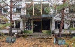
First stop was "Prypiat Middle School No. 3" in order to get out of the rain.
Entrance:
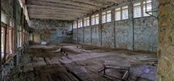
Sports hall:
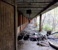
Precarious flooring:
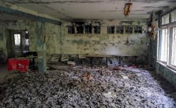
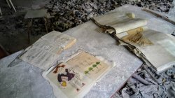
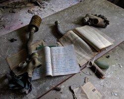
One of the most famous locations for photos is the canteen, where gas masks (which were stockpiled at the school, but never actually distributed) have been spread on the floor by photographers looking to create an eerie atmosphere.
Street view / photosphere link (not mine)
We then ventured in to the city of Prypiat (Pripyat), the new city which was built to serve the employees of the power plant. It was evacuated on the 27th April 1986, the day after the Chornobyl disaster.
First stop was "Prypiat Middle School No. 3" in order to get out of the rain.
Entrance:

Sports hall:

Precarious flooring:

One of the most famous locations for photos is the canteen, where gas masks (which were stockpiled at the school, but never actually distributed) have been spread on the floor by photographers looking to create an eerie atmosphere.


Street view / photosphere link (not mine)
Last edited:
HeavyElectricity
Active Member
- Joined
- May 24, 2015
- Posts
- 690
- Qantas
- Gold
- Virgin
- Platinum
Chornobyl Exclusion Zone Day 1
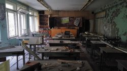
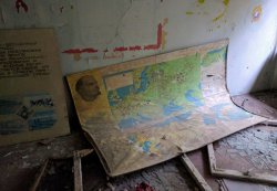
I found the classrooms very interesting, showing a mixture of educational/communist posters, and also schoolwork on display - demonstrating the 'frozen in time' state of the city.
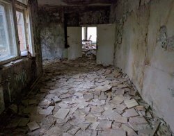
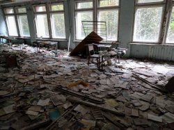
Corridor with school books scattered all over the floor (again, I presume by photographers wanting to create an eerie atmosphere, as there is no reason for them to be spread on the floor like this):
Classrooms:
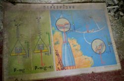
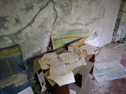
Science posters:
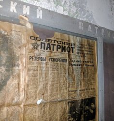
Newspaper displayed on corridor noticeboard, dated 23rd April 1983 (3 days before the incident):
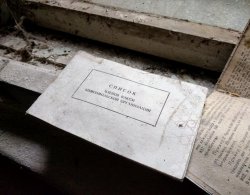
Register of the "Komsomol" (All-Union Leninist Young Communist League / Young Communist League):
School display:
Anatomy teaching aid:
Textbook:
Street view / photosphere link (not mine)
I found the classrooms very interesting, showing a mixture of educational/communist posters, and also schoolwork on display - demonstrating the 'frozen in time' state of the city.
Corridor with school books scattered all over the floor (again, I presume by photographers wanting to create an eerie atmosphere, as there is no reason for them to be spread on the floor like this):

Classrooms:


Science posters:


Newspaper displayed on corridor noticeboard, dated 23rd April 1983 (3 days before the incident):

Register of the "Komsomol" (All-Union Leninist Young Communist League / Young Communist League):

School display:

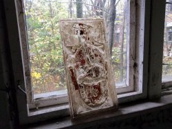
Anatomy teaching aid:

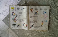
Textbook:

Street view / photosphere link (not mine)
Last edited:
bPeteb
Established Member
- Joined
- May 24, 2011
- Posts
- 3,230
- Qantas
- Platinum
Brilliant photos. Would love to see this place. I've seen the text book and gas mask photos many times and wondered why they are where they are. I reckon you're right. Looking forward to seeing more.Chornobyl Exclusion Zone Day 1
I found the classrooms very interesting, showing a mixture of educational/communist posters, and also schoolwork on display - demonstrating the 'frozen in time' state of the city.
Corridor with school books scattered all over the floor (again, I presume by photographers wanting to create an eerie atmosphere, as there is no reason for them to be spread on the floor like this)
Boca68
Established Member
- Joined
- Jan 24, 2015
- Posts
- 1,010
Great report, and as above looking forward to seeing more.
It is fascinating, but seems Sludge is only updating every 6 months or so
Like Cossie, I'd love to see more.
HeavyElectricity
Active Member
- Joined
- May 24, 2015
- Posts
- 690
- Qantas
- Gold
- Virgin
- Platinum
It is fascinating, but seems Sludge is only updating every 6 months or so.....(not a criticism, just an observation)
Like Cossie, I'd love to see more.
Yep, guilty as charged. I've been very bad at getting around to sorting my photos, but I'm determined to do it, and won't give up - I'm just slow.
I'll be doing some regular updates this week, as I've pretty much sorted photos from the first day of the tour now. I'd been skipping sorting the school photos, as I had so many. I still haven't begun looking at day 2 however!
I can't remember if I said before, but I took as many photos in these 2 days as I had taken from 2008 to 2015. Plus a lot are bad quality due to the darkness inside the buildings (particularly on the first day when it was overcast and raining as well). It's been tough culling them down.
HeavyElectricity
Active Member
- Joined
- May 24, 2015
- Posts
- 690
- Qantas
- Gold
- Virgin
- Platinum
Just a small observation regarding the English spelling of place names I've been referring to, as I found it quite interesting.
I've been attempting to use the Ukrainian to English translation of place names. Our guide pointed out that the disaster and subsequent coverage of the event was whilst the USSR still existed. Therefore the Russian to English spellings such as "Chernobyl", "Kiev", "Pripyat" were commonly used and seen, even now, rather than the Ukrainian to English "Chornobyl", "Kyiv", and "Prypiat".
Technically, Pripyat and the Chernobyl Nuclear Power Plant were constructed during the USSR, so you could argue that the Russian-English is correct. However, the power station was named after Chornobyl town (which is very old), and Pripyat after the Prypiat river, so really the Ukrainian-English can be used for them.
I find myself getting confused and using a mixture, but have tried to use the Ukrainian-English where possible.
HeavyElectricity
Active Member
- Joined
- May 24, 2015
- Posts
- 690
- Qantas
- Gold
- Virgin
- Platinum
Chornobyl Exclusion Zone Day 1
Adjoining the middle school is Prypiat Swimming Pool "Lazurny" Azure. This is another popular photo spot in Prypiat, and has featured in video games.
The swimming pool was actually kept operational for 10 years after the disaster, for those working at the remaining reactors at the power plant.
The building also houses a gymnasium:
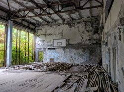
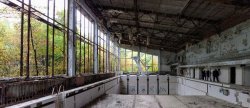
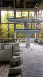
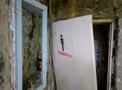
Street view / photosphere link (not mine)
Adjoining the middle school is Prypiat Swimming Pool "Lazurny" Azure. This is another popular photo spot in Prypiat, and has featured in video games.
The swimming pool was actually kept operational for 10 years after the disaster, for those working at the remaining reactors at the power plant.
The building also houses a gymnasium:


Street view / photosphere link (not mine)
Last edited:
HeavyElectricity
Active Member
- Joined
- May 24, 2015
- Posts
- 690
- Qantas
- Gold
- Virgin
- Platinum
Chornobyl Exclusion Zone Day 1
I thought people might find it interesting if I include some Google street view / photosphere links along with the photos (unfortunately not mine, I didn't think to take any):
I thought people might find it interesting if I include some Google street view / photosphere links along with the photos (unfortunately not mine, I didn't think to take any):
Last edited:
HeavyElectricity
Active Member
- Joined
- May 24, 2015
- Posts
- 690
- Qantas
- Gold
- Virgin
- Platinum
Chornobyl Exclusion Zone Day 1
Next we explored one of the 16-storey apartment buildings on the edge of Prypiat.
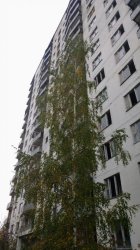
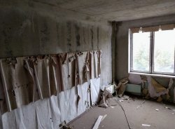
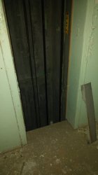
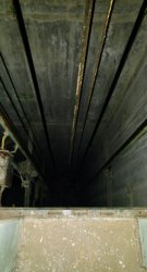
The scariest aspect of walking up to the top floor was that a lot of the lift shaft doors had been smashed/looted (scrap metal is valuable to looters - e.g. radiators are very popular items which have been taken). Walking past an open lift shaft in the dark with uneven flooring covered in debris makes your heart skip a beat:
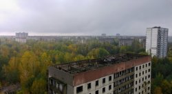
The views from the top floor were fantastic - here is the view across Prypiat. It's fascinating to see a city 'reclaimed' by nature like this:
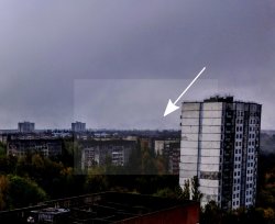
In the background (very faintly), you can see the New Safe Confinement and Reactor No. 4 sarcophagus - it really gives you some scale of how big the 'arch' is - here is my attempt to 'enhance':
Street view / photosphere link (not mine)
Next we explored one of the 16-storey apartment buildings on the edge of Prypiat.


The scariest aspect of walking up to the top floor was that a lot of the lift shaft doors had been smashed/looted (scrap metal is valuable to looters - e.g. radiators are very popular items which have been taken). Walking past an open lift shaft in the dark with uneven flooring covered in debris makes your heart skip a beat:


The views from the top floor were fantastic - here is the view across Prypiat. It's fascinating to see a city 'reclaimed' by nature like this:

In the background (very faintly), you can see the New Safe Confinement and Reactor No. 4 sarcophagus - it really gives you some scale of how big the 'arch' is - here is my attempt to 'enhance':

Street view / photosphere link (not mine)
Last edited:
HeavyElectricity
Active Member
- Joined
- May 24, 2015
- Posts
- 690
- Qantas
- Gold
- Virgin
- Platinum
Chornobyl Exclusion Zone Day 1
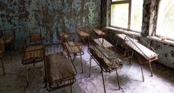
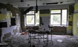
"Prypiat Hospital No. 126" was where the first casualties from the disaster were taken, before there had even been any announcement about an incident.
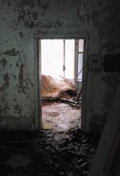
The basement contains the dumped highly radioactive clothing from the fire-fighters and other first responders, and should therefore not be entered without appropriate protective filters and suit. Apparently people were venturing down and taking items anyway, so the authorities had recently filled in the stairwell with sand:
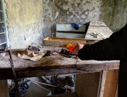
The inner-lining from a fire-fighter’s helmet taken from the basement had been left on the bench in the reception area. Our guide demonstrated that it was still highly radioactive with beta particles:
Street view / photosphere link (not mine)
Understandably the abandoned hospital feels quite uncomfortable / eerie:

Street view / photosphere link (not mine)
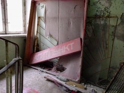
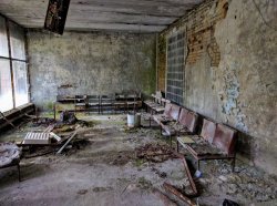
"Prypiat Hospital No. 126" was where the first casualties from the disaster were taken, before there had even been any announcement about an incident.
The basement contains the dumped highly radioactive clothing from the fire-fighters and other first responders, and should therefore not be entered without appropriate protective filters and suit. Apparently people were venturing down and taking items anyway, so the authorities had recently filled in the stairwell with sand:

The inner-lining from a fire-fighter’s helmet taken from the basement had been left on the bench in the reception area. Our guide demonstrated that it was still highly radioactive with beta particles:

Street view / photosphere link (not mine)
Understandably the abandoned hospital feels quite uncomfortable / eerie:


Street view / photosphere link (not mine)


Last edited:
Read our AFF credit card guides and start earning more points now.
AFF Supporters can remove this and all advertisements
HeavyElectricity
Active Member
- Joined
- May 24, 2015
- Posts
- 690
- Qantas
- Gold
- Virgin
- Platinum
This video of the hospital basement from 2015 gives me shivers, and I'm glad we went nowhere near it.
(start watching from around 5mins in)
(start watching from around 5mins in)
Last edited:
HeavyElectricity
Active Member
- Joined
- May 24, 2015
- Posts
- 690
- Qantas
- Gold
- Virgin
- Platinum
Chornobyl Exclusion Zone Day 1
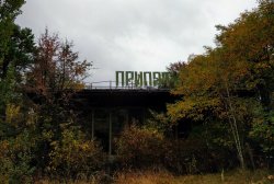
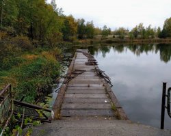
Café Prypiat, located next to the waterfront and a small jetty, was a popular location for locals to relax:

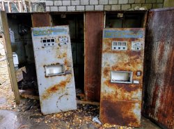
Our guide pointed out this old drinks vending machine. Apparently they dispensed a strong syrup which was topped up with soda(?) water.
It was common for there to be one glass left at the machine for people to use, which could be cleaned by placing it upside down on a rinser!
Inside the cafe, the stained glass design of the windows was quite impressive:

Street view / photopshere link (not mine)
Café Prypiat, located next to the waterfront and a small jetty, was a popular location for locals to relax:


Our guide pointed out this old drinks vending machine. Apparently they dispensed a strong syrup which was topped up with soda(?) water.
It was common for there to be one glass left at the machine for people to use, which could be cleaned by placing it upside down on a rinser!

Inside the cafe, the stained glass design of the windows was quite impressive:

Street view / photopshere link (not mine)
HeavyElectricity
Active Member
- Joined
- May 24, 2015
- Posts
- 690
- Qantas
- Gold
- Virgin
- Platinum
Chornobyl Exclusion Zone Day 1
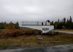
On the way out of Prypiat, we stopped at the city's welcome sign. It's located next to the Red Forest, one of the most contaminated areas in the world today.
Street view / photosphere link (not mine)
On the way out of Prypiat, we stopped at the city's welcome sign. It's located next to the Red Forest, one of the most contaminated areas in the world today.

Street view / photosphere link (not mine)
Last edited:
HeavyElectricity
Active Member
- Joined
- May 24, 2015
- Posts
- 690
- Qantas
- Gold
- Virgin
- Platinum
Chornobyl Exclusion Zone Day 1
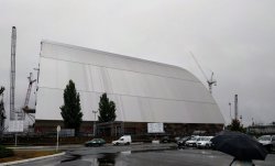
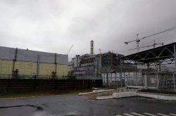
We then reached the power plant itself. It was very surreal viewing the iconic sight of Reactor No. 4 and the sarcophagus. The construction of the 110x165x260m New Safe Confinement 'arch' was pretty much complete, and was scheduled to be moved over the sarcophagus the following month. It was fortunate timing we managed to see both the sarcophagus and completed New Safe Confinement on this trip.
New Safe Confinement:
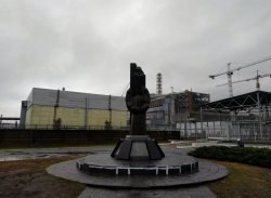
Memorial to those who build the shelter/sarcophagus:
Reactor No. 4:
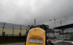
Dosimeter reading (higher than most other places, but not drastically high):
Street view / photosphere link (not mine)
We then reached the power plant itself. It was very surreal viewing the iconic sight of Reactor No. 4 and the sarcophagus. The construction of the 110x165x260m New Safe Confinement 'arch' was pretty much complete, and was scheduled to be moved over the sarcophagus the following month. It was fortunate timing we managed to see both the sarcophagus and completed New Safe Confinement on this trip.
New Safe Confinement:

Memorial to those who build the shelter/sarcophagus:

Reactor No. 4:

Dosimeter reading (higher than most other places, but not drastically high):

Street view / photosphere link (not mine)
Last edited:
HeavyElectricity
Active Member
- Joined
- May 24, 2015
- Posts
- 690
- Qantas
- Gold
- Virgin
- Platinum
Chornobyl Exclusion Day 1
On the drive back to Chornobyl town, we stopped at Kopachi. Kopachi village was demolished house-by-house and buried, each site is marked with a radiation sign.
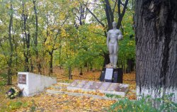
World War II memorial by the roadside:
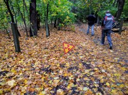
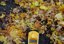
The radiation warning signs could be seen in the surrounding woodland, and there are hotspots in the soil:
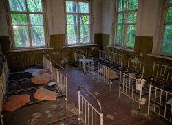
Kopachi Kindergarten is one of only two buildings still standing, both being of brick construction:
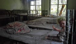
Street view / photosphere link (not mine)
On the drive back to Chornobyl town, we stopped at Kopachi. Kopachi village was demolished house-by-house and buried, each site is marked with a radiation sign.
World War II memorial by the roadside:

The radiation warning signs could be seen in the surrounding woodland, and there are hotspots in the soil:


Kopachi Kindergarten is one of only two buildings still standing, both being of brick construction:


Street view / photosphere link (not mine)
HeavyElectricity
Active Member
- Joined
- May 24, 2015
- Posts
- 690
- Qantas
- Gold
- Virgin
- Platinum
Chornobyl Exclusion Zone Day 1
And that was the end of the first day of the tour! We arrived at the hotel in Chornobyl town, passing back in to the "30km" exclusion zone (from the "10km" exclusion zone), which required us to go through radiation detectors at the checkpoint.
I can't remember exactly what was provided for dinner at the hotel, other than it was quite interesting. Spaghetti I think. We had a few beers (during the permitted hours - alcohol is otherwise banned in the zone) with a few people from our group, and then retired to our room. Whilst the accommodation was very basic, it was perfectly fine and actually quite impressive considering where we were. It was much better than what I'd been expecting. Only one of the shared showers was working, but it was of a modern design and was very welcome.
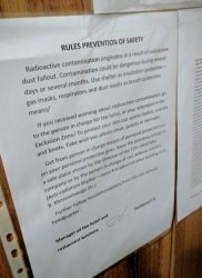
We had a chuckle at the title on the "safety" notice hung in the room:
It will likely be a while before I start posting photos from Day 2, as I haven't begun sorting through those yet.
I hope people have found this interesting, and not just an endless stream of decaying building photos!
And that was the end of the first day of the tour! We arrived at the hotel in Chornobyl town, passing back in to the "30km" exclusion zone (from the "10km" exclusion zone), which required us to go through radiation detectors at the checkpoint.
I can't remember exactly what was provided for dinner at the hotel, other than it was quite interesting. Spaghetti I think. We had a few beers (during the permitted hours - alcohol is otherwise banned in the zone) with a few people from our group, and then retired to our room. Whilst the accommodation was very basic, it was perfectly fine and actually quite impressive considering where we were. It was much better than what I'd been expecting. Only one of the shared showers was working, but it was of a modern design and was very welcome.
We had a chuckle at the title on the "safety" notice hung in the room:

It will likely be a while before I start posting photos from Day 2, as I haven't begun sorting through those yet.
I hope people have found this interesting, and not just an endless stream of decaying building photos!
Last edited:
HeavyElectricity
Active Member
- Joined
- May 24, 2015
- Posts
- 690
- Qantas
- Gold
- Virgin
- Platinum
Chornobyl Exclusion Zone Day 2
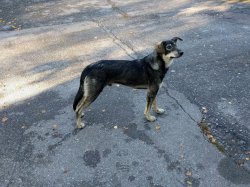
Breakfast at the hotel was quite filling, and somewhat unusual - spaghetti again! A pack of wild dogs met us outside the hotel in the morning. Our guide told us that although wild, they are quite tame, and prefer to be close to people as that protects them from other predators in the zone (wolves).
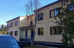
Our hotel in Chornobyl town:
On our way out of Chornobyl town we made two stops. The first was to a monument entitled "Those who saved the world", constructed by locals outside the town fire station in memory of the first responders.
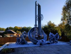
Street view / photosphere link (not mine)
We then stopped at an exhibit of robotic equipment used in the liquidation process. Our guide told us that a lot of these robots were donated by other countries to help with the immediate cleanup, but all failed after a short time (often just hours) due to the high radiation levels - apparently the soviets told the countries providing these robots that the radiation levels were a lot lower than they actually were. "Bio-robots" were then used to clean dangerous core fragments from the roof of the adjacent buildings - these bio-robots were in actual fact just soldiers with shovels.
Although the robots were cleaned for display, they are still quite radioactive.

As you can probably tell by the photos, the weather on the second day was much improved, and we enjoyed the brilliant blue sky and sunshine.
Breakfast at the hotel was quite filling, and somewhat unusual - spaghetti again! A pack of wild dogs met us outside the hotel in the morning. Our guide told us that although wild, they are quite tame, and prefer to be close to people as that protects them from other predators in the zone (wolves).

Our hotel in Chornobyl town:

On our way out of Chornobyl town we made two stops. The first was to a monument entitled "Those who saved the world", constructed by locals outside the town fire station in memory of the first responders.

Street view / photosphere link (not mine)
We then stopped at an exhibit of robotic equipment used in the liquidation process. Our guide told us that a lot of these robots were donated by other countries to help with the immediate cleanup, but all failed after a short time (often just hours) due to the high radiation levels - apparently the soviets told the countries providing these robots that the radiation levels were a lot lower than they actually were. "Bio-robots" were then used to clean dangerous core fragments from the roof of the adjacent buildings - these bio-robots were in actual fact just soldiers with shovels.
Although the robots were cleaned for display, they are still quite radioactive.

As you can probably tell by the photos, the weather on the second day was much improved, and we enjoyed the brilliant blue sky and sunshine.
Last edited:
HeavyElectricity
Active Member
- Joined
- May 24, 2015
- Posts
- 690
- Qantas
- Gold
- Virgin
- Platinum
Chornobyl Exclusion Zone Day 2
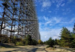
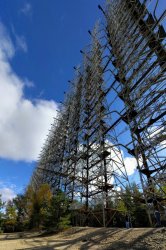
We left Chornobyl town and made the ~15km journey north-west to the secret soviet military base of "Chornobyl-2" (not labelled on Google Maps - but there is street view!), home to the immense Duga-1 over-the-horizon radar array. Only opened to tour groups in 2013, it's not as well known as some of the more typical zone locations (such as Prypiat).
Designed to detect ballistic missile launches, the ~0.8km long and almost 50 storey high array was called 'the Woodpecker' by amateur radio operators due to the interference it generated on radio transmissions.
Soviet military gates to Chornobyl-2 town at the checkpoint:
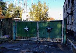
Approaching the Duga-1 radar array:
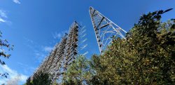
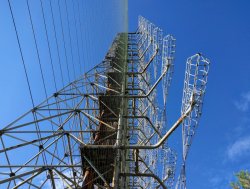
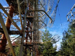
It's difficult for the photos to do justice to how huge this structure is:
Ladders leading up to the first platform:
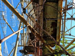
There were also a few elevators built-in to the structure:
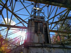
Some people climb up this old rust-bucket:
Street view / photosphere link (not mine)
An attempt to stitch photos together to show the size:
Street view / photosphere link (not mine)
We left Chornobyl town and made the ~15km journey north-west to the secret soviet military base of "Chornobyl-2" (not labelled on Google Maps - but there is street view!), home to the immense Duga-1 over-the-horizon radar array. Only opened to tour groups in 2013, it's not as well known as some of the more typical zone locations (such as Prypiat).
Designed to detect ballistic missile launches, the ~0.8km long and almost 50 storey high array was called 'the Woodpecker' by amateur radio operators due to the interference it generated on radio transmissions.
Soviet military gates to Chornobyl-2 town at the checkpoint:

Approaching the Duga-1 radar array:


It's difficult for the photos to do justice to how huge this structure is:


Ladders leading up to the first platform:

There were also a few elevators built-in to the structure:

Some people climb up this old rust-bucket:
Street view / photosphere link (not mine)
An attempt to stitch photos together to show the size:

Street view / photosphere link (not mine)
Last edited:
- Status
- Not open for further replies.
Become an AFF member!
Join Australian Frequent Flyer (AFF) for free and unlock insider tips, exclusive deals, and global meetups with 65,000+ frequent flyers.AFF members can also access our Frequent Flyer Training courses, and upgrade to Fast-track your way to expert traveller status and unlock even more exclusive discounts!

AFF forum abbreviations
Wondering about Y, J or any of the other abbreviations used on our forum?Check out our guide to common AFF acronyms & abbreviations.
Currently Active Users
- Medicus
- flyingfan
- TheTravellingWino
- furiousmango
- Justinf
- Timhn
- RSD
- DejaBrew
- exceladdict
- Saab34
- tielec
- wenglock.mok
- kerfuffle
- hill
- axkhanna1
- hydrabyss
- Fifa
- bPeteb
- trippin_the_rift
- JessicaTam
- cgichard
- vhojm
- jswong
- ccmcknz
- tigertraveller
- Duggo
- grantcarlson
- SomeRando
- Corey27
- ksthommo
- Kwong
- trooper
- Le_Champion
- lakes8
- tassie6
- dajop
- Robliversage
- Buzzard
- torks
- redwoodw
- Balus1
- aussie flyer
- ShrinkWrapped
- Cottman
- Peter78
- fletty
- blackcat20
- mccaffd
- Oubline
- Harrison_133
Total: 749 (members: 61, guests: 688)


