The Ireland trip - with some detours.

Status
Not open for further replies.
Some more photos in the sun. All these photos are taken within about 15 KM of Killarney.

The advantage of following a bus is that it just barges through and you follow along.

DSCN3077.jpg

As you can see this road is very busy.

DSCN3079.jpg

It passes some nice lakes along the way

DSCN3078.jpg

DSCN3082.jpg

DSCN3083.jpg
 
That evening we went to have a look at the water at Kells Beach just down from our B & B - which was at Glenbeigh, about 35 KM anti-clockwise from Killarney on the Ring of Kerry Loop.

It was nice evening, probably about 20C,and water wasn't too cold. The beach was sand with boulders and gravel dumped on the edge after major erosion caused by a big storm a couple of years ago.

IMG20170525192139.jpg

The last of the "artfully framed" shots. I like it because of the lovely wave patterns. There are actually a lot of surfing beaches just north of here.

P1080082.jpg

Looking back at the sort of country you drive around & through on the Ring of Kerry - that is our hire car. This afternoon was one of the nicest we had.

DSCN3099.jpg


You can see the make up of the beach here.

P1080080.jpg

And we finally had a lovely sunset. This is just east of Kells Beach

P1080095.jpg
 
The B & B

I have been disparaging about some of what we encountered in Ireland - especially the weather. However, I could not complain about the B&Bs' that we stayed in which were all comfortable. The hosts were invariably friendly. They offered tips about the best places to eat, sights to see and where to go on the next part of trip. The breakfasts we were served varied from very good to excellent and the variety offered was good. As an example of what you can expect here are some photos from Glenbeigh - Hillcrest House.

The self serve options in the dining room. Many of them served home made brown Soda Bread like here but we also had Treacle Bread as well. .

IMG-20170526-WA0003.jpg

Then there were the cooked options. I only had the "Full Irish Breakfast" once- too much for even me. There was always a choice of brown or white toast.

IMG-20170526-WA0006.jpg

The view out of the dining room window.

1495782527362.jpg


When you got sick of bacon there were often options like porridge. However , one of the nicer options was smoked salmon and eggs- done in a number of ways.

IMG-20170526-WA0005.jpg
 
Aahh Irish soda bread just lovely - never been able to recreate at home

when I was a young backpaper I had many a marmalade sandwich for lunch after pilfering from the B&B
 
Aahh Irish soda bread just lovely - never been able to recreate at home

when I was a young backpaper I had many a marmalade sandwich for lunch after pilfering from the B&B

I don't recall ever having eaten it before and I was surprised how nice it was - and softer than I thought it would be.
 
I stayed all in BnBs and those brekkys are really something and combined with driving around was good for less weight control for a while not mention artery hardening.
 
The Frequent Flyer Concierge team takes the hard work out of finding reward seat availability. Using their expert knowledge and specialised tools, they'll help you book a great trip that maximises the value for your points.

AFF Supporters can remove this and all advertisements

Ring of Kerry

After tantalising us with the lovely weather the previous afternoon the Irish Weather Gods taught us a lesson the nest day when we did our planned circuit of The Ring Of Kerry. I am glad we did it but there is no doubt that our enjoyment of the day was marred by the weather.

Good driving conditions with expansive views from the road

P1080152.jpg

We weren't always in the clouds but views that would have been lovely were restricted - looking inland from the Cliffs of Kerry

P1080147.jpg

Looking out to sea from the Cliffs of Kerry. The island is Puffin Island. Skellig Michael is a bit further offshore and I think I caught a glimpse of it once or twice.
It was cold and windy and the cliffs seemed very high to me, so if I don't seem very comfortable in this photo it is because I wasn't - I do not like heights.

IMG20170526124120.jpg


These cliffs are over 300 metres high and very spectacular - even in this weather.

IMG20170526120944.jpg
 

Attachments

  • P1080151.jpg
    P1080151.jpg
    71.1 KB · Views: 101
Some of the other sights we saw around the Ring

Ballcarberry Castle - you see numerous fascinating ruins around Ireland

.P1080110.jpg

Only 1Km or so from these ruins are some Ring Forts. This one is the Cahergal Stone Fort - built around 600AD (It has obviously had some reconstruction work done)

P1080114.jpg


DSCN3155_Moment.jpg


The car ferry to Valentia Island . There is a bridge at the other end of the island. Because the tourist bases do not come onto the island it is easier driving and has similar terrain to the mainland.

P1080117.jpg

A brief bit of lighter skies gave a indication of what the views could be like.

IMG20170526150403.jpg


(I will not post any more photos around the Ring of Kerry as they are basically all of gloomy skies and cloudy views. However, I will recommend that anyone with a sweet tooth drop in at Skellig Chocolate https://www.skelligschocolate.com/ On a good day (ha ha) you can apparently see Skellig Michael from their site. They offered a very generous sample tray and a member of staff explained each chocolate to you and asked for your preferences for the next sample. Their varieties included mixes I would never have thought sensible but they tasted very nice .e.g. Rose & Pistachio, Gin & Tonic, Lime Zest & Black Pepper. Their more "ordinary" chocolate was nice as well. They also had what appeared to be a very nice on-site cafe.)

The next day we did a tour of the Dingle Peninsula and the weather gods were nicer and gave us some sun - still cold and windy but a lot nicer day.

Inch Beach - a surfing area (And where the film Ryan,s Daughter was shot)

View attachment 100809

Some "beehive" stone huts at Fahan. The date of these huts is unknown as these type of huts were being constructed from 3100 BC until earlier this century. The guess seems to be about the 12th century.

View attachment 100810

A photo to prove that they do surf in these waters

P1080163.jpg


And they can teach you how to surf

P1080224 - Copy.jpg

Some nice green hills and white cottages. But even on this day the clouds were low.

P1080186.jpg
 
More of Dingle

The roads on this drive were no better than most of the rest of Ireland - that is too small to handle the amount of traffic they now get. This impasse required much backing and maneuvering to resolve. The same camper-van held us up on a number of corners as it was really too big for these roads. It was also not helpful that the passenger had a propensity to hop out and take photos in the middle of the road when traffic was trying to pass..

P1080184.jpg

Some more rolling green hills

P1080173.jpg

This is Great Blaskett Island "Until 1953, the inhabitants of Great Blasket Island formed the most westerly settlement in Ireland. The small fishing community (even at its peak the population was hardly more than 150) mostly lived in primitive cottages perched on the relatively sheltered north-east shore. In April 1947, having been cut off from the mainland for weeks due to bad weather, the islanders sent a telegram to the Taoiseach, Éamon de Valera, urgently requesting supplies which duly arrived two days later by boat." "The island was inhabited until 1953, when the Irish government decided that it could no longer guarantee the safety of the remaining population."

P1080195.jpg


Most of the island is now a National Park. Irish Heritage have now built an excellent Visitors Centre on the mainland opposite the island - free to us with our trusty passes. It tells the history of the islanders and like most of the various Irish Heritage sites we visited there was a film about the history of the site - in this case it was shown in an about 100 seat theatre'. This was a very big visitor centre and very well planned and curated.

I know just how he feels about the weather.

P1080193.jpg

The island had a remarkable literary and artistic heritage for the size of the population.

Inside the Visitor Centre

IMG20170527131107.jpg
 
Sponsored Post

Struggling to use your Frequent Flyer Points?

Frequent Flyer Concierge takes the hard work out of finding award availability and redeeming your frequent flyer or credit card points for flights.

Using their expert knowledge and specialised tools, the Frequent Flyer Concierge team at Frequent Flyer Concierge will help you book a great trip that maximises the value for your points.

Dingle yet again

In an earlier post I mentioned about how good the cafes attached to the visitor centres were.
For example, at the Great Blaskett Visitor Centre (this cafe had about 30 tables) we had the lunch special of a home made soup (with a slice of soda bread and butter) plus a choice of an open sandwich for about €8. The food tasted as good as it looks.

IMG20170527123820.jpg

Part of the outside of the centre - the cafe is on the right

IMG20170527133441.jpg

Afterwards, we crossed over to the other side of the Dingle Peninsula using Conor Pass - the highest mountain pass in Ireland. It is subject to fog & low clouds but we were lucky enough
to get sun - even if it was windy.

Another winding, narrow hillside road.

P1080215.jpg

Views from the top of the pass. Even though we were in the sun you can see that the clouds are still touching the other peaks. The stone lines by the
lake below are stone walled sheep pens and more ancient beehive huts.

P1080207.jpg

There are some pretty views on the Dingle Peninsula

DSCN3208.jpg
 
Onto the Cliffs of Moher

After 3 nights in Ring country we headed towards our next stopover near the famous cliffs. We now started following "The Wild Atlantic Way" Wild Atlantic Way Official Travel Site | Discover things to see and do
This a brilliant marketing exercise to encourage touring up Ireland's West Coast. Most of the B & B's have guide books to it and even if you don't have a map the route is clearly signposted and often gives you options to detour to attractive spots off the main route. It is well worthwhile researching and following its recommendations.

Tralee was on the way there so we dropped in to have a look. However, it was Sunday morning and the town centre was deserted and locked tight. There is a nice central park in town which has this display honouring the Rose of Tralee. Looking at the winners names shows more "Australian Irish" have won it than I had realised.

DSCN3261.jpg

Another ancient lookout tower. Right next to a very old cemetery.

P1080243.jpg


To save some driving time we didn't go via Limerick but instead took the Kilrush Ferry (Tarbert to Killiber) across the Shannon Estuary.

IMG20170528124233.jpg

This Raven (?) is obviously a regular passenger on the ferry. It landed shortly after departure and happily hopped around the rails of the ferry until close to the other side. It was completely unafraid of humans. and only took notice if anyone offered it food.

DSCN3294.jpg

Francis Street in the very attractive town of Kilrush. One the few wide streets we ever came across in Ireland - 30 metres wide. The town had a lot of re-building work done by the local "Lords of the Manor" in the 18th Century. We visited the Walled Garden of that Manor House later that day. (the Manor House is long gone.)


DSCN3301.jpg
 
Thanks for the photos of the Conor Pass brought back old memories of family holidays to a place nearby called Castlegregory, we used to go there every year when we were kids.

Some beautiful scenery to be had in that part of Ireland, if the weather cooperates!
 
Vandeleur Walled Garden - Kilrush. Vandeleur Walled Garden | Kilrush | Co. Clare | Ireland | - built early in the 19th Century.

I had seen walled gardens on TV but it wasn't until I actually visited one that I could really understand how the walls do make such a nice micro-climate in a harsh environment. It is free to visit, has plenty of parking and an on-site cafe. Plants are also for sale - not much use for us.

Outside the walls - gives little idea of what lies within.

P1080279.jpg

Inside the walls

P1080276.jpg

P1080273.jpg

P1080269.jpg

The access road to our B & B near the Cliffs of Moher. This road helps explain why you cannot rely on the driving times given by your GPS in Ireland - well, even less so than normally. It is signposted as an 80Km speed limit a speed that would be manifestly dangerous. Especially, as this bit was the widest part of the road.

IMG20170528181804.jpg
 
Thanks for the photos of the Conor Pass brought back old memories of family holidays to a place nearby called Castlegregory, we used to go there every year when we were kids.

Some beautiful scenery to be had in that part of Ireland, if the weather cooperates!


I am glad they bought back memories. We drove through Castlegregory when we went out to Ballycurane. I am pretty sure these are photos of the Strand near there.

DSCN3234.jpg

DSCN3235.jpg

And a couple more of Conor Pass as well. The road on the Dingle side appears to have been rebuilt in the last couple of years while the northern side seems a lot older - and more dangerous.

DSCN3219.jpg

P1080216.jpg
 
B&B - Cliifs of Moher

I am putting some photos of our B & B - Blue Horizons Ballyvaskin - because I "owe" the operator for going "above and beyond" for me. At the end of our stay there we headed north. After about 3 hours driving I realised that I had left my backpack, with Passports etc, in the entrance hall of the B&B when I went upstairs to say goodbye. We, of course, had to turn around and drive back. When we got back & retrieved it we found out that the owner had already discovered it and had tried to ring us first - we were probably in a "dead" zone. He then had a look at our itinerary and rang our next B & B to give them a message to pass on to us that he had found it and would express courier it to us the next day. Luckily, we got back before he had done so.

He was a "surfer dude" who had actually spent several years in Australia & still teaches surfing. During the summer he works as a lifeguard at some of the close-by beaches. This B &B was purpose built to his own design.

So:-

The B & B - it had a great view towards the "back" of the cliffs

DSCN3317.jpg

The view from the B & B

IMG-20170528-WA0005.jpg

A couple of compulsory sunset shots.

(From the Guest Lounge -1st floor)

P1080296.jpg

(From our bedroom window - ground floor)

P1080292.jpg

I do have to admit that the access road is "interesting". We met this truck two days in a row - we backed up. It is actually the road repair truck. It is a single-man operation with a jib in front that seems to pump bitumen into the pot-holes. It was a machine like this Council spends €700k on high-tech pothole-filling machines | Irish Examiner - so pretty expensive.

1496097557551.jpg
 
Walking the Cliffs of Moher

Thanks to the good advice of our B & B host we did not park at the Visitor Centre and endure the human ant heap around that area.
Not to mention the €6 per head Entry Fee and €6 parking fee. Instead we parked near the Napoleonic War Signal Tower at the southern end of the cliffs.
There is parking in a farmers car park - €2 in an honesty box. There is about a 1Km walk to the trail along the cliffs. It is about 3 km along the Cliffs to the main tourist site.
The trail along here has been upgraded in recent years, moved back a bit from the edge (good for me), graveled and contoured.

At first it was the normal cloudy damp day and then to our surprise in a rush blue skies appeared and there was brilliant sunshine - this was to teach me a lesson as I hadn't bothered to bring a cap and therefore got slightly burnt on the top of my head.

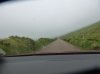
Cloudy and grey at first - but still impressive

P1080313.jpg

Started to improve

DSCN3361.jpg

And ended up like this

P1080401.jpg

Here you can see the old path and the new path for wimps like me

P1080384.jpg

The Irish Navy or Coastguard were having a bit of fun just offshore - the water was glassy

P1080347.jpg
 
More views along the cliffs.

The tower on this headland was our destination. It was built as more of a folly than a working tower.

P1080389.jpg

Looking back from where we had started - under the "genuine" tower. It is on the far right of the cliffs. This was the headland in the sunset photos from our B & B - which was above the water on the far left of the photo.

P1080355.jpg

As we got closer to the Visitor Centre other people, and animals, started to appear - including the famous Irish Mountain Cows;)

P1080399.jpg

Looking towards the Visitor Centre, which is mostly underground. I am sorry that it is not a particularly good photo. It does, however, give you an idea of the crowds here and not in peak season. The first group of vehicles is only the tour buses - so about 40 - 50 people in each of them. The second group of vehicles is the crowded car park.


DSCN3358.jpg

An idea of the sheer edges - and how close people get - but not me.

P1080371.jpg


Last of the cliffs

It was about a 6 hour round trip including buying sandwiches at the Visitor Centre and stopping for long looks.

I hadn't realised how close the Aran Islands seem to be to the Cliffs of Moher. They are actually about 21 Km offshore - the height of the cliffs (max. 214 Metres) certainly give a good viewpoint. I was using a Panasonic Lumix TZ40 camera.

The water was so smooth that you could just about water-ski over to them.

DSCN3368.jpg

Housing and dry stone fences on a couple of the islands.

P1080397.jpg

People do this around the world - I never understand the attraction. In fact, later on this same day when we were in The Burren we came across Heritage Ireland signs asking people not to make cairns - https://www.lonelyplanet.com/ireland/county-clare/the-burren

DSCN3363.jpg


It is really lovely, as was the weather at this time.

DSCN3371.jpg


DSCN3372.jpg
 
Status
Not open for further replies.

Become an AFF member!

Join Australian Frequent Flyer (AFF) for free and enjoy a better viewing experience, as well as full participation on our community forums.

AFF members can also access our Frequent Flyer Training courses, and upgrade to enjoy lots of other benefits and discounts!

AFF forum abbreviations

Wondering about Y, J or any of the other abbreviations used on our forum?

Check out our guide to common AFF acronyms & abbreviations.
Back
Top